

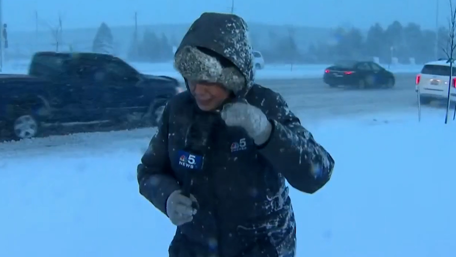
After an unseasonably mild month of December, this week has brought two winter storms to the Chicago area, with Friday's event poised to impact commuters for the second time today.
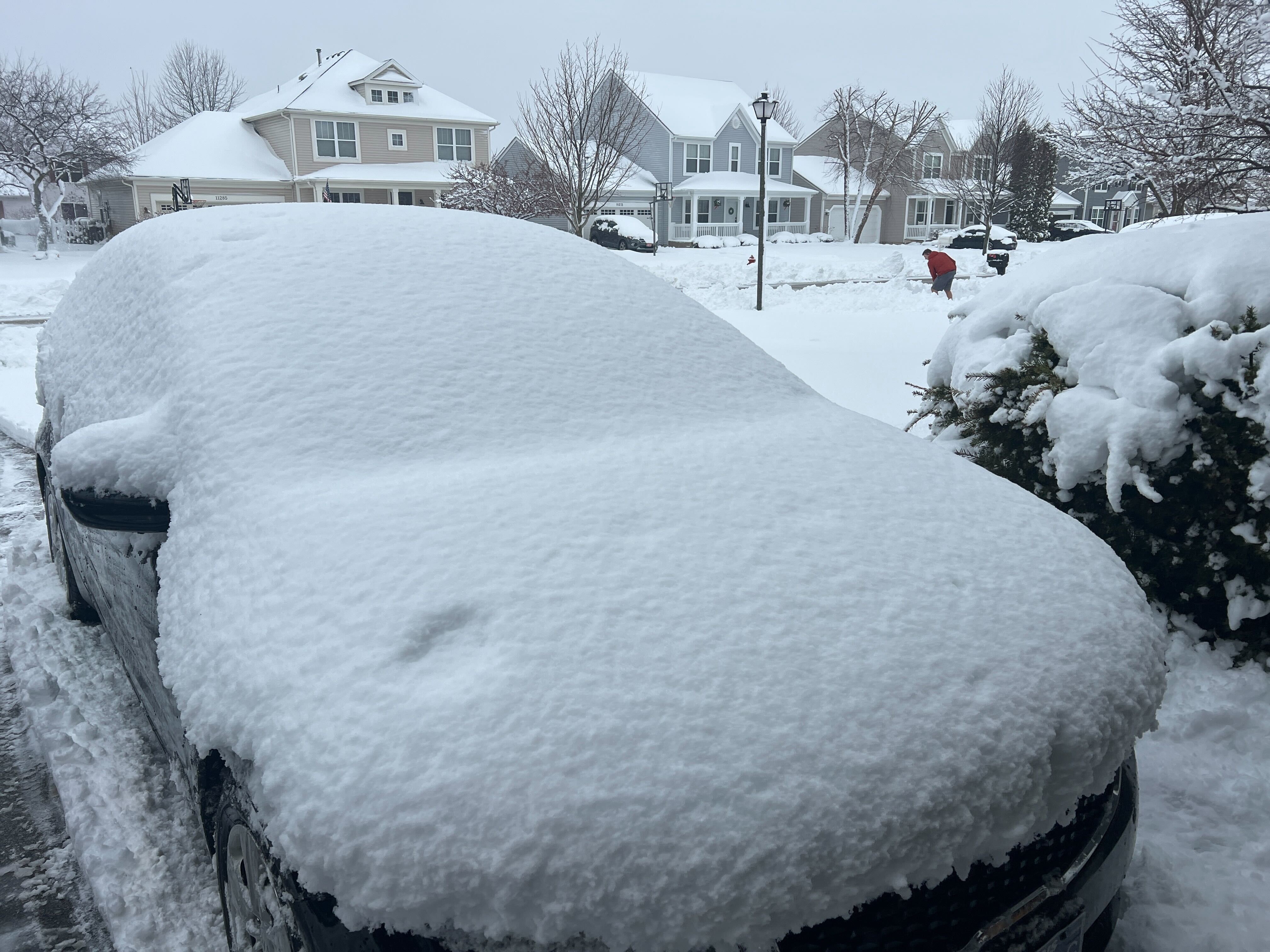
Chicago-area residents were greeted Friday morning to as many as six inches of snow and power outages in some areas, leading to widespread travel complications on a day where more than 100 schools across the region were closed.
While much of the precipitation from overnight and this morning has switched from snow to rain in many parts of the Chicago area, the storm is expected to transition back into a snow-only event this evening as temperatures drop.
Those who live north of I-90 are likely still seeing a wintry mix in the early afternoon hours, while the precipitation has transitioned to mostly rain south of the highway.
With the upcoming evening round of snow, areas north and northwest of Chicago are likely to see the biggest impacts, with up to 6 inches of additional accumulation still possible, combined with dangerous wind gusts of up to 45 mph.
Several counties remain under a winter storm warning through Saturday, including McHenry, DeKalb, Kane, DuPage, Lake, and northern and central Cook counties. The warning remains in effect until noon Saturday and warns of 3 to 5 inches of additional accumulation expected.
The conditions could again make travel dangerous across the area, regardless of snow totals, with high winds likely leading to blowing snow and dropping temperatures potentially making for icy roads in some spots.
According to the National Weather Service, the greatest travel impacts will be through the early evening hours "primarily for areas north of I-80."
Due to the inclement weather, Chicago Public Schools announced that all after-school and out-of-school activities on both Friday and Saturday have been canceled, with the district monitoring weather conditions for early next week, when high temperatures may not climb above 0 degrees.
Feeling out of the loop? We'll catch you up on the Chicago news you need to know. Sign up for the weekly Chicago Catch-Up newsletter here.
Additionally, Chicago's City Hall and other administrative offices will close at 2 p.m. ahead of the evening commute.
The NWS warned travelers to expect "downright dangerous travel conditions" across much of the area, especially in Northern Illinois during the evening commute as the snow continues to ramp up.
Other parts of the Chicago area will be under a winter weather advisory, particularly for areas south of Chicago and in northwest Indiana.
LaSalle, Kendall, Grundy, southern Cook and Will counties in Illinois will be under a winter weather advisory through noon Saturday. The advisory also takes effect in Kankakee County in Illinois and Lake, Porter, Newton and Jasper counties in northwest Indiana.
Travel issues were widespread this morning, with crashes and downed power lines contributing to complications.
Some roadways were closed due to numerous accidents and "disabled vehicles" in the area, with some also closed for downed power lines. Thousands were without power as the storm hit Friday morning.
Interstate 355 saw southbound lanes closed between Finley Road and Ogden Avenue due to an accident. Numerous ramps were closed on the Tri-State Tollway due to vehicle issues.
At 10:45 a.m., the Kane County Sheriff's office said it was responding to "several cars in the ditches."
"Use caution and only travel in an emergency. There is a small break in the snow but it is going to pick up."
Check Road Conditions
It may be a good idea to check road conditions, so you know what expect.
You can do so through maps and reports, traveler information and more using a tool from the Illinois Department of Transportation called "Getting Around Illinois."
The tool allows you to look up current Illinois road conditions in a number of ways:
Here are a few resources:
Latest information on the Chicago snowstorm
You can find our latest stories on the Chicago snowstorm below:
- Live snow radar map: Track weather near you as storm snarls Chicago area
- Snow totals: Latest snow totals in Chicago and Illinois as snowfall as continues
- Illinois winter road conditions: Buses rerouted, crashes reported and more
- Power outages: Tens of thousands of ComEd customers without power amid winter storm
- Flights canceled: Ground delay at O'Hare, thousands of flights canceled across Chicago airports
