
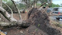
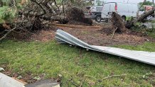
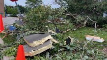
Several Chicago suburbs are facing extensive storm damage cleanup after "multiple tornadoes" tracked across Northeast Illinois Wednesday, leaving roofs ripped off homes, massive trees uprooted, car windows blown out, debris from shopping centers strewn across parking lots and more.
"Between 5 p.m. and 7 p.m. on Wednesday, July 12, multiple tornadoes tracked across Northeast Illinois, some in very close proximity to one another," a tweet from the NWS said. "These were spawned by rotating thunderstorms known as supercells."
According to the NWS, the total number of tornado touchdowns from Wednesday has yet to be finalized, adding that a final number count should be completed as the week goes on.
"We currently do not have an estimate of the total number of tornadoes," the NWS said. "We will determine the official count along with intensity ratings following damage surveys over the coming days."
Feeling out of the loop? We'll catch you up on the Chicago news you need to know. Sign up for the weekly Chicago Catch-Up newsletter here.
Although an exact estimate as to the number and exact locations of the twisters has yet to be confirmed, damage from Wednesday's severe weather remains clear.
In McCook, Total Traffic reports morning road closures due to storm damage.
Local

Elsewhere, suburban residents recapped what it was like after severe weather ripped through the shopping centers where they were running errands.
"It was just everything was blowing everywhere," a witness told NBC Chicago, of the damage outside of a Menard's in Hodgkins. "And it was coming from that direction but then all of a sudden it was going all over it was blowing all over it was like no way to go to protect yourself from it."
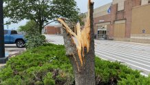
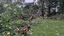
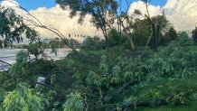
Here's a look at what the storm aftermath looks like across Chicago suburbs.
Hodgkins
Elgin
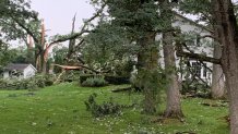
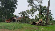

Burr Ridge
Why did "multiple" tornadoes hit at once?
According to the NBC 5 Storm Team, the specific weather phenomenon that caused 'multiple' tornadoes to touch down is known as an "outflow boundary," or a "gust front."
"Those boundaries are the leading edge of cool surface-level winds that result from the downdrafts of thunderstorms, like the ones that formed early in the afternoon on Wednesday in the Chicago area," NBC 5 Meteorologist Brant Miller said. "Those cool winds race towards the ground, and can spread out far beyond where they originated from."
When that happens, Miller said, "the air often bumps into warm and unstable air and then acts like a wedge, forcing that warm air upward."
Additionally, "new thunderstorms can often form in these areas, and if they run into the outflow boundary, the low-level wind shear can cause thunderstorms to exhibit rotation, and that’s when tornadoes can form," Miller said.
