
Severe thunderstorms were moving their way across northern Illinois and northwest Indiana early Wednesday morning, leaving much of the region under a severe thunderstorm watch.
Wednesday morning's storms mark the third round of severe weather hitting the region in the last 24 hours after severe weather struck Tuesday morning and evening.
How long could they last?
Here's what to expect and when:
6 a.m. Wednesday
Severe weather has started inching its way into the Chicago area at this time.
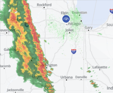
A severe thunderstorm watch, which remains in effect until 11 a.m., includes more than 50 counties across Illinois and northwest Indiana.
Local
A tornado warning has now been issued for all of DeKalb County until 6:45 a.m., according to the National Weather Service.
At 6:11 a.m., a severe thunderstorm capable of producing a tornado was located near Paw Paw, moving to the northeast at 60 miles per hour.
Feeling out of the loop? We'll catch you up on the Chicago news you need to know. Sign up for the weekly Chicago Catch-Up newsletter here.
Radar indicated rotation within the cell, and residents are urged to seek shelter if they are in the path of the storm.
A severe thunderstorm warning was also issued for parts of DeKalb, Kane, Kendall and LaSalle counties until 7 a.m., warning of damaging winds gusts of up to 60 mph.
A severe thunderstorm warning was also issued for Porter and Lake counties in northwest Indiana until 6 a.m. CT and for northern LaPorte County until 6:15 a.m. CT.
See the latest severe weather alerts for your area here
There, storms were reportedly bringing 60 mph wind gusts and quarter-sized hail.
Storms are approaching from the west, with severe thunderstorm warnings popping up in several counties.
A tornado warning has also been issued until 6:15 a.m. in western Illinois, just outside of the Chicago area, with radar indicating rotation within a storm cell in that area. It is moving to the northeast at 55 miles per hour, with parts of LaSalle and DeKalb counties potentially in its path as it moves along.
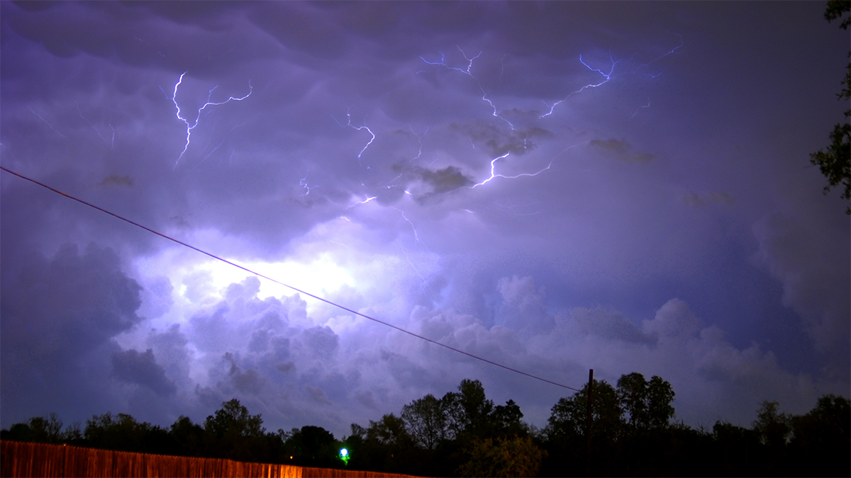
Storms are expected to increase across the I-39 corridor through the 6 a.m. hour, with damaging winds and hail the main threats, according to forecast models, along with frequent lightning.
Tornadoes cannot be ruled out with these systems.
7 a.m. Wednesday
The severe threat was expected to hit most through 7 a.m.
Parts of the Chicago area, including Cook, Will, Grundy and Kankakee counties, are at an "enhanced risk" of severe weather Wednesday morning, with all of northwest Indiana also fitting into that category, according to the Storm Prediction Center.
The rest of the NBC 5 viewing area is at a "slight risk" of severe storms, per the SPC guidance.
11 a.m. Wednesday
The severe thunderstorm watch remains in effect across the entire region until 11 a.m.
Later Wednesday
Even after the storms pass later in the morning, a wind advisory will be in effect until 4 p.m., with wind gusts in excess of 40 miles per hour possible after the front finally clears the region.
Images Show Massive Hail Spotted Across Chicago Area as Storms Erupt
After Wednesday
Here's the latest on what's ahead from the NBC 5 Storm Team:
THURSDAY: Mostly sunny and cool. HIGH: Upper 40s
FRIDAY: Mostly to partly sunny. HIGH: Low 50s
SATURDAY: Mostly to partly sunny. HIGH: Upper 50s
