
From 70-degrees, to the potential for golf-ball sized hail and then snow: Wild weather is on the horizon for the Chicago area, beginning with high temperatures that could become the warmest ever recorded in Chicago during winter.
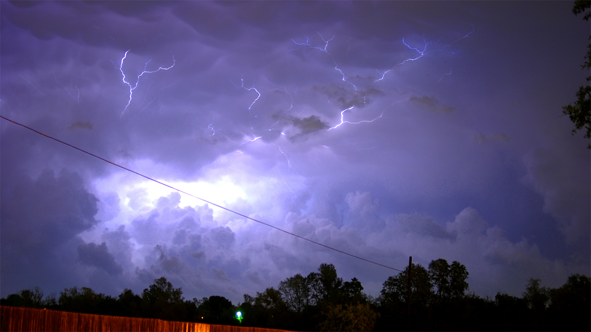
"We are in for an absolutely wild meteorological ride, with summer (record warmth), spring (severe storms?), and winter (snow/cold) weather all crammed into the next 24 hours!" a tweet from the National Weather Service said.
According to the NBC 5 Storm Team, temperatures early Tuesday were already warm, with readings in the upper 50s areawide. That's approximately 20 degrees warmer than it was early Monday morning, NBC 5 meteorologist Alicia Roman said.
As the day goes on, those temperatures will continue to climb. By 12 p.m., the Chicago area is expected to hit 73 degrees. At around 2 p.m., the city is expected to hit a record-breaking forecast high of 76 degrees, Roman said.
"The current record high of 75 degrees was set in 1976," Roman said. "76 would be the warmest temperature ever recorded in February, and in meteorological winter in Chicago.
After the forecast high is hit, temperatures will begin to tumble, Roman said, and the chances for severe thunderstorms roll in.
Local
"If you want to get out and enjoy, do it before 4 p.m. or 5 p.m.," Roman said, of the expected storm timing.
Around that time and through evening, the entire Chicago area will be under a "slight" risk of severe weather, which ranks as level two of five on the Storm Prediction Center's severe weather scale. If storms do develop, Roman said, the biggest threats they carry are gusty, damaging winds of up to 60 miles-per-hour, large hail and more.
Feeling out of the loop? We'll catch you up on the Chicago news you need to know. Sign up for the weekly Chicago Catch-Up newsletter here.
"Maybe an isolated tornado threat if all the elements come together," Roman said, adding that storms moving in from the west are expected to be scattered rather than areawide.
Around 10 p.m., those storms are expected to move out, Roman said, followed by plummeting temperatures and the potential for snow.
Cold air is expected to surge in overnight, along with rain and a light coating of snow, mostly in Northwest and Northwest Illinois. Temperatures early Wednesday will hover in the 20s and 30s, with wind chill values in the teens, Roman said.
By 8 a.m., the snow is expected to move out. After that, a cold and blustery day will set in, Roman said, with afternoon temperatures in the upper 20s to low 30s.
"From June to January," Roman said, of the dramatic shift in temperature and weather conditions.
The cold air will be short-lived, Roman said. By Thursday, temperatures will begin to creep back up, with highs in the mid-40s. Friday will see temperatures in the 50s, Roman said, followed by temperatures in the low-to-mid 60s by the weekend.
