
The Chicago area began to dry out Thursday morning after severe weather hit parts of the region. Lauren Petty has details.
Stay alert: download the NBC Chicago app and turn on push notifications to get weather alerts directly to your phone in case of severe weather.
Severe weather moved through portions of the Chicago area overnight, bringing lightning and damaging winds to some suburbs.
A Tornado Watch for several counties in northern Illinois and northwest Indiana was canceled just after 3 a.m.
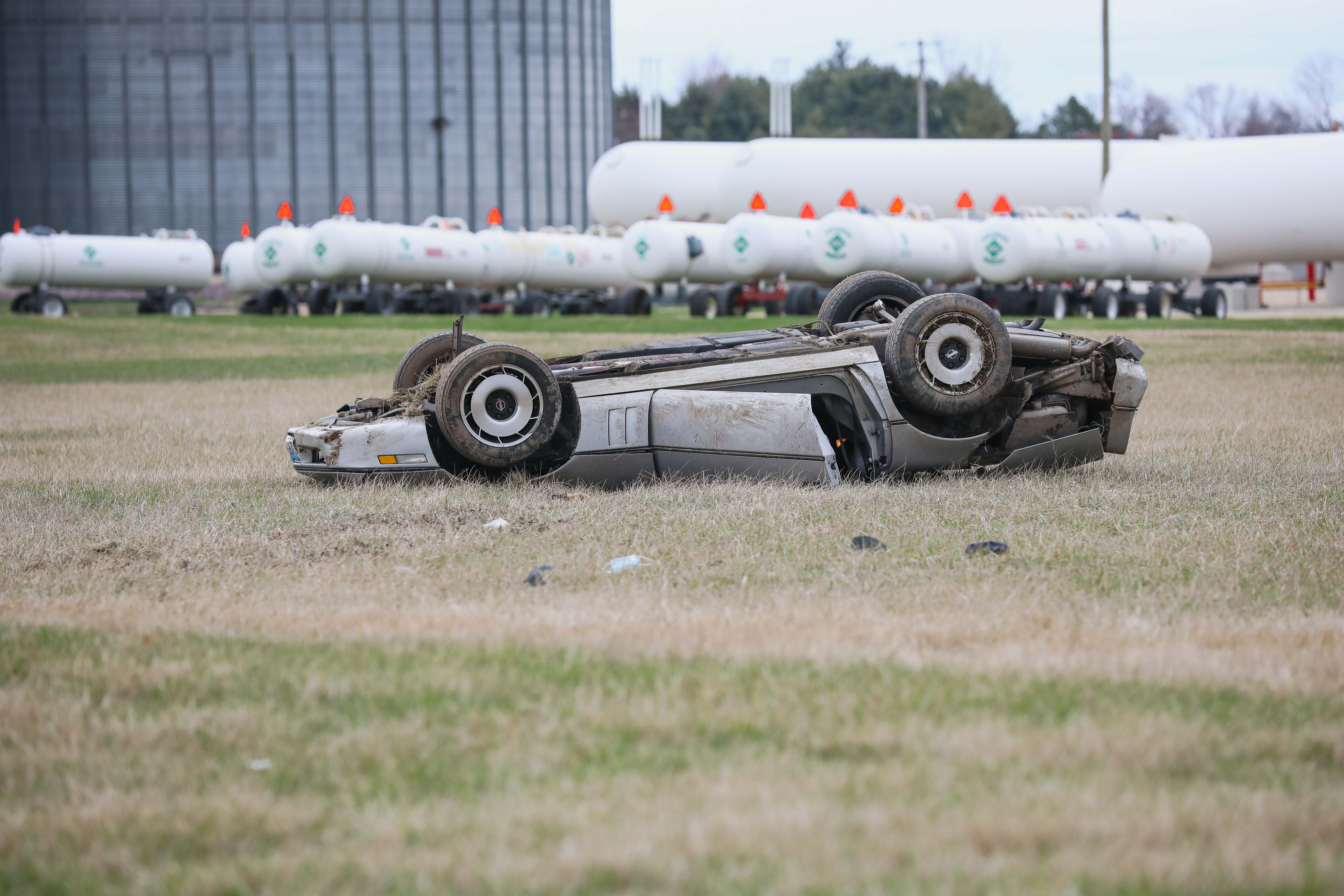
A line of severe storms was reported in areas far south of Chicago, bringing 70 mph wind gusts and nickel-sized hail.
Track the storms with Live Doppler Radar
The storms prompted a Tornado Warning for parts of Livingston, Ford and Iroquois counties, where the National Weather Service said a severe thunderstorm capable of producing a tornado was located. Fairbury police reported a funnel cloud in the area, according to the National Weather Service.
The National Weather Service reported power outages and downed trees near Gibson City in Ford County early Thursday morning. Meanwhile, wind damage and gusts of up to 67 mph were reported in Jasper County, Indiana.
Local
In Watseka, Illinois, reports from authorities indicated numerous trees, power lines, and telephone poles were down near US Route 24. Roads were being blocked off in the area, the NWS reported.
Check severe weather alerts in your area
The threat for severe weather continued overnight, mostly south of Interstate 80.
Some areas that have already received heavy rain could potentially experience localized flash flooding as a result of the storm.

The severe threat could potentially last beyond Thursday morning. The area will still see a chance of storms throughout the rest of the week and into the weekend, with forecasted high temperatures expected to remain around the 80-degree mark in most locations.