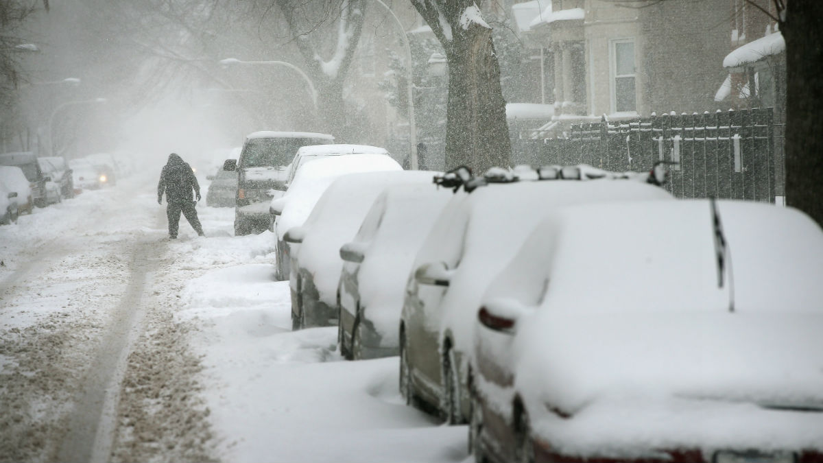
While there remains some uncertainty surrounding just how much snow the Chicago area will see in the upcoming winter storm, experts say the storm is still expected to be dangerous.
That's because it's not about how much snow falls - it's about the dangerous conditions that will be in place as the snow falls.
We're talking high winds and bitter wind chills combined with the potential for measurable snow.
"This time around, snow amounts aren't the story," the National Weather Service tweeted. "The combination of strong winds + plunging temperatures + falling snow is the problem."
While current predictions show lower totals in parts of the Chicago area than earlier this week, a lot could change what you actually see.
But the guidance won't change: Do not travel Friday if you don't have to.
Any snow that does fall Thursday night and Friday will likely be mixed with 45-60 mph wind gusts that could make for "blizzard" or "white out" conditions, particularly Friday.
"These conditions can quickly reduce visibility to near zero," said NBC 5 Storm Team meteorologist Paul Deanno.
Add to that the fact that wind child temperatures will drop to between -20 and -30 degrees by Friday afternoon, making any time spent outdoor dangerous and bringing the potential for icy road conditions on top of the blowing snow.
Feeling out of the loop? We'll catch you up on the Chicago news you need to know. Sign up for the weekly Chicago Catch-Up newsletter here.
"If possible, consider alternate travel plans," the NWS tweeted.
A winter storm watch begins Thursday morning in McHenry, DeKalb, Kane, LaSalle, Kendall and Grundy counties.
Things will "rapidly" worsen heading into Thursday afternoon, with snow growing more widespread and becoming stronger.
A winter storm watch for Lake, DuPage, Kankakee, Cook and Will counties in Illinois, and Lake, Porter, Newton and Jasper counties in northwest Indiana begins Thursday afternoon, according to the NWS.
The alert warns that "falling and blowing snow may result in white out conditions with zero visibility at times, making travel extremely difficult, if not impossible."
"Power outages will also be possible as a result of strong damaging wind gusts to 55 mph," it states.
Icy roads could add to the hazardous conditions as temperatures rapidly fall.
The winter storm watch is slated to continue through late Friday evening as the storm and potentially "blizzard-like" conditions hold strong.
Forecasts are unclear as to how much snow may actually fall as snow but the snow is expected to begin subsiding overnight.
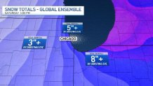
Early predictions so far indicate the Chicago area could see between 5 and 9 inches of snow, with higher totals possible, especially in northwest Indiana. Some locations could also see lower totals.
But according to the NBC 5 Storm Team, when all is said and done, the amount of snow left in your area could be deceiving. While the totals will depend on the storm itself, they'll also depend on the wind.
"Some places will look like they got a foot or more of snow because the strong winds deposited 'extra snow' there," Deanno said. "Other places may look like little snow fell because the wind carried much of it away."
The strong winds are expected to linger through Saturday and the dangerously cold wind chills are set to continue through the Christmas holiday.
Difficult travel conditions could linger, particularly in the morning hours Saturday, as blowing and drifting snow remains a concern.