
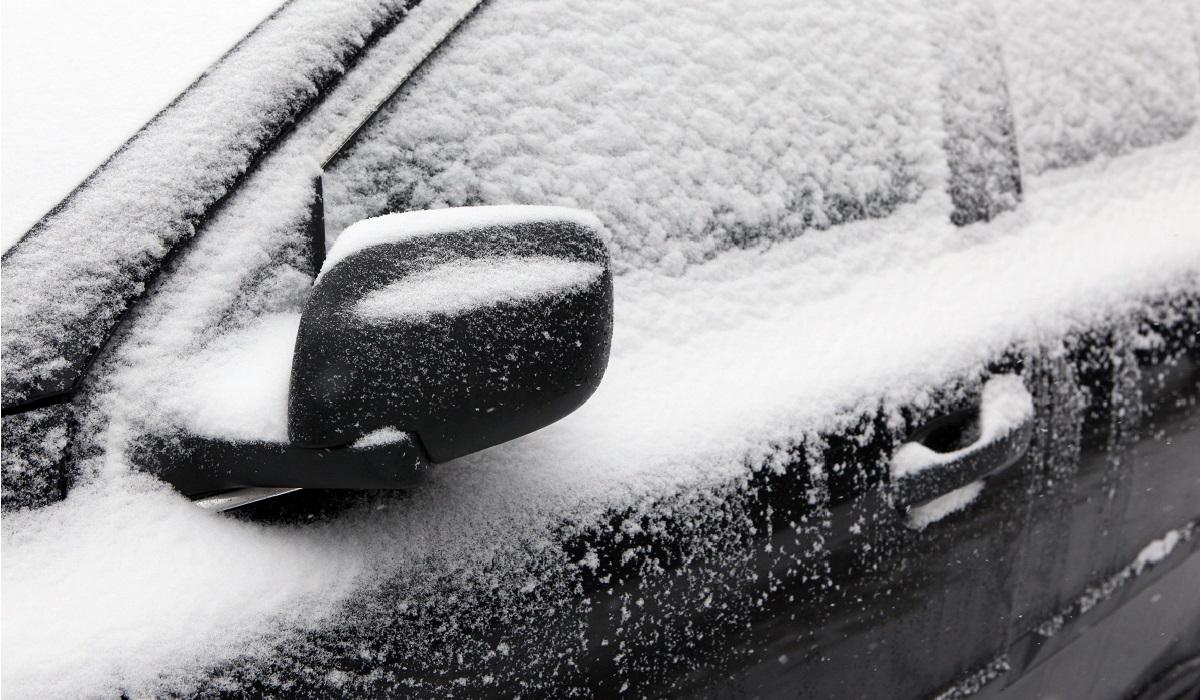
The Chicago area sure had a nice stretch of the temperatures in the 50s, 60s and 70s the past few weeks. But it's now time to get those warm weather jackets, gloves and hats out of storage for good -- because the cold weather is officially here.
According to NBC 5 Storm Team, Monday is expected to be mild and dry, with a partly-to-mostly cloudy sky, and high temperatures in the low 40s.
But as Monday evening sets in, snow showers are predicted to develop.
Read More: Old Farmer's Almanac Releases Extended Forecast for Upcoming Winter in Chicago Area
Feeling out of the loop? We'll catch you up on the Chicago news you need to know. Sign up for the weekly Chicago Catch-Up newsletter here.
Forecast models show widespread snow showers beginning around 7 a.m. Tuesday, making for a slick morning commute. Closer to Lake Michigan, those snow showers will mix with rain, NBC 5 Storm Team says. And while there may be some afternoon lulls, a rain and snow mix is forecast for the Chicago area throughout the afternoon.
Though it may be wet, accumulations are predicted to be on the lighter side, with one-to-two inches of accumulation expected in most areas, NBC 5 Storm Team says.

According to NBC 5 Storm Team, temperatures Tuesday are expected to be just above freezing.
Similar conditions are expected into Wednesday and Thursday, with small amounts of accumulation possible.
And from there, things will only get colder.
According to forecast models, temperatures are expected to drop as the week goes on, with highs expected to reach only into the mid-20s by Friday.
When Does Chicago Typically See its First Snowfall?
According to the National Weather Service, the average date that Chicago typically sees its first measurable snowfall is Nov. 18.
O'Hare International Airport has seen two ends of extremes in recent years, with 2019's first measurable snowfall coming on Oct. 30, the seventh-earliest measurable snowfall in Chicago since 1967.
Read More: Chicago Could See a Snowier Winter Than Normal. See NOAA's New Predictions
Just last year, Chicago saw its latest first measurable snowfall of all-time, according to the National Weather Service. Snow did not fall at O'Hare Airport until Dec. 28, when 1.5 inches of snowfall were recorded.
The earliest snowfall record was set on Oct. 12, 2006, when 0.3 inches of snow fell at O'Hare.
Here's a look at when the city saw its first snowfall over the past 10 years, and how much snow fell:
- 2012: Dec. 20, 0.2 inches
- 2013: Nov. 11, 0.4 inches
- 2014: Oct. 31, 0.1 inches
- 2015: Nov. 20, 4.2 inches
- 2016: Dec. 4, 6.4 inches
- 2017: Nov. 10, 0.1 inches
- 2018: Nov. 9, 1 inch
- 2019: Oct. 30, 1.2 inches
- 2020: Nov. 24, 0.7 inches
- 2021: Dec. 28, 1.5 inches
When Does Winter Officially Begin?
The official start of the next season is still more than a month away.
Although meteorological winter begins on Dec. 1, astronomical winter is tied to the winter solstice each year, which occurs when the North Pole is at its' furthest location away from the sun, creating the year's shortest day.
According to the National Weather Service, the astronomical change in seasons will occur at 3:48 p.m. on Tuesday, Dec. 21. This day will mark the shortest day of the year, although Dec. 22 will mark the first full day of winter.
Despite starting near the end of the months they begin in, astronomical seasons and meteorological seasons both last for approximately three months.
