
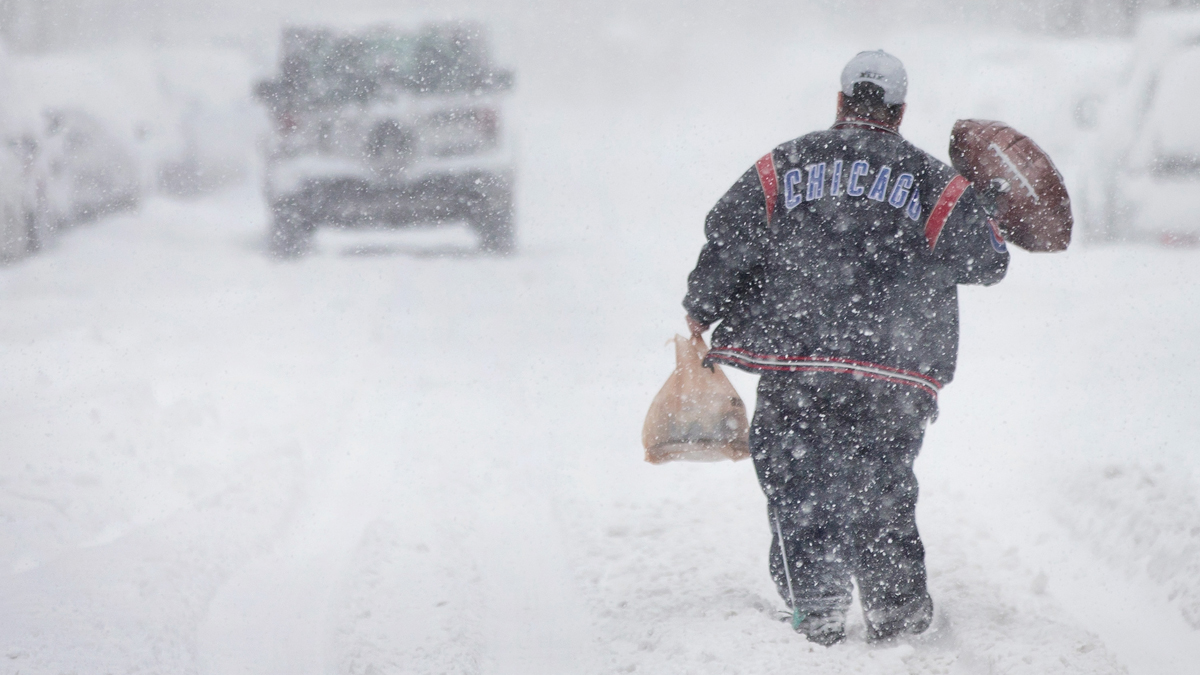
Snow total projections continue to change in the lead-up to the major winter system set to halt travel ahead of the Christmas holiday in the Chicago area.
The latest projections show there may not be much in accumulation, but experts, including the NBC 5 Storm Team, say that's only one part of the story.
While the current predictions may not seem noteworthy, "it's not just the snow," NBC 5 Storm Meteorologist Paul Deanno said. It's the combination of snow, high winds and dangerously cold wind chills.
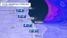
Still, some areas could see more than 8 inches of snow, while others see closer to 3 inches, though models were still fluctuating even hours before the storm was set to arrive.
Deanno also noted that wind could play a role in how much snow is left behind in your area. While some locations may see several inches of snow, that may not be the total left behind due to the high wind gusts blowing the snow to other locations.
"Some places will look like they got a foot or more of snow because the strong winds deposited 'extra snow' there," NBC 5 Meteorologist Paul Deanno said. "Other places may look like little snow fell because the wind carried much of it away."
Here's what else you should know about the storm:
When the Snow Will Start?
Forecasters now expect some snow to develop starting Wednesday evening across northwest Illinois. The real snow, however, will begin Thursday morning in the western portion of the area first, shifting east toward the city by the early afternoon.
Feeling out of the loop? We'll catch you up on the Chicago news you need to know. Sign up for the weekly Chicago Catch-Up newsletter here.
When Will the System Be Worst?
While it was expected that the storm wouldn't intensify until later Thursday, travel conditions are now expected to "rapidly deteriorate" by the evening rush hour.
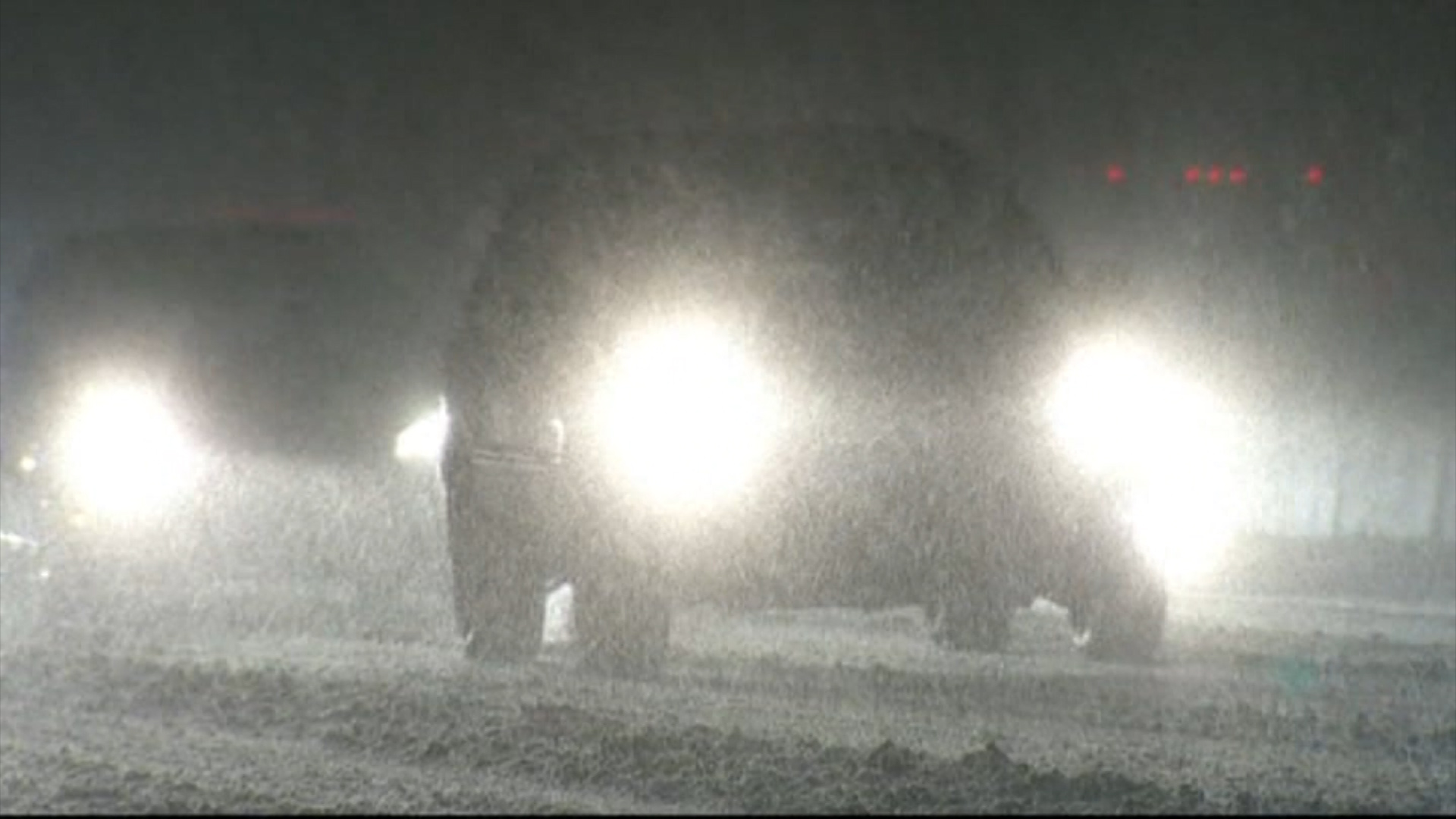
Blizzard conditions are possible Thursday afternoon and into Friday morning, according to the National Weather Service, with "brutal" travel conditions anticipated.
Still, according to NBC 5 Storm Team Meteorologist Paul Deanno, the "window of concern" will likely be between 8 p.m. Thursday and 12 p.m. Friday. During that period, the snow will likely become moderate to heavy at times, paired with wind gusts of up to 55 mph and visibility near zero at times. Not to mention wind chills of up to -35 degrees.
"Even when the snow stops, winds will still be strong," Deanno said. "So snow will be blowing around all over the place, making it look like it’s still snowing."
Winter Storm Warning
The entire Chicago area has been upgraded to a winter storm warning, with timing shifting by location.
The winter storm warning will begin at 9 a.m. Thursday in McHenry, DeKalb, Kane, LaSalle, Kendall and Grundy counties, according to the NWS. The warning will take effect in Lake, DuPage, Kankakee, Cook and Will counties in Illinois at noon and in Lake, Newton and Jasper counties in northwest Indiana starting at 3 p.m. CT.
It will remain in effect across the area until 6 a.m. Saturday.
Porter County, Indiana will see a blizzard warning beginning at 3 p.m. CT Thursday and continuing until 6 a.m. Saturday. The National Weather Service noted that such a warning is not based on snowfall amounts, but instead on winds and visibility.
According to the warning, "falling and blowing snow will result in white out conditions with zero visibility at times, making travel extremely difficult, if not impossible."
Wind gusts of up to 55 mph could also lead to power outages and ice-covered roads are possible as temperatures "rapidly fall" late Thursday afternoon and into early Thursday evening. From Thursday night and into Friday, wind chills as low as 35 degrees below zero are likely.
Dangerous Travel Conditions
The National Weather Service is warning travelers and motorists -- whether they're taking trip out of town or just down the road -- that travel conditions during the height of the storm could be potentially "life-threatening."
The storm comes amid one of the busiest travel times of the year. According to AAA, 113 million Americans -- 5.8 million in Illinois -- are expected to travel 50 miles or more between Dec. 23 and Jan. 2. Wednesday and Thursday alone, the Illinois Tollway estimating that 1.7 million vehicles are expected to use the tollway system.

And according to the Chicago Department of Aviation, approximately 2.9 million air travelers are expected to pass through O'Hare and Midway International Airports between Dec. 21 and Jan. 2.
What Are Blizzard Conditions?
According to NBC 5 Storm Team, a specific set of conditions must be met in order for a weather pattern to be considered a blizzard. They include snow or blowing snow, wind gusts of at least 35 miles-per-hour, and visibility of a quarter-mile or less.
All three of those conditions must be present for at least three hours for a storm to be labeled a blizzard, NBC 5 meteorologists report.
According to NWS, the snowiest Christmas on record for the Chicago area took place in 1950, when the city say just over five inches of snow.
