
Tuesday marks the first day of spring, and while temperatures will feel appropriate for the occasion, it’ll feel more like late winter for the rest of the week.
According to the NBC 5 Storm Team, that could include cooler temperatures and even a chance for snow in coming days, with a clipper system and then a stronger system arriving to wrap up the week and heading into the weekend.
Here’s what we know about the forecast so far.
Tuesday:
Feeling out of the loop? We'll catch you up on the Chicago news you need to know. Sign up for the weekly Chicago Catch-Up newsletter here.
Chicago will get a brief respite from cooler weather on Tuesday, with winds shifting out of the southwest for several hours.
High temperatures are expected to climb into the mid-50s in most locations, with some locally higher readings possible, but the good times won’t last long, as winds are expected to shift again late Tuesday night and into Wednesday morning.
Wednesday:
Local

Winds coming out of the northwest will put a damper on the first full day of spring, which technically begins just after 10 p.m. on Tuesday.
Sunny skies will be the order of the day, but high temperatures are expected to only rise into the low-40s, below their seasonal averages for this time of year.
Thursday:
Temperatures will likely remain in the low-40s, but cloud cover will start to build in during the day on Thursday and into the evening hours.
Precipitation isn’t expected to arrive Thursday at this point, but the timeline could be accelerated as a clipper system approaches the region.
Friday:
The aforementioned clipper system is expected to arrive Friday morning, and could have an impact on the morning commute in numerous locations.
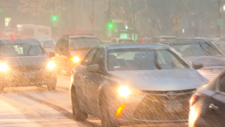
While temperatures will help determine what kind of precipitation will fall, the expectation is that many areas could potentially see at least some snow on Friday morning.
Accumulations aren’t expected to be heavy, but travel could be slick and visibility could be impacted in areas north and west of the city of Chicago.
Other areas could see mixed precipitation or even rain, according to forecast models.
Saturday:
Temperatures will once again be around the 40-degree mark, but some positive changes will likely be approaching even as another storm system arrives late Saturday and into Sunday morning.
Sunday:
Chances of rain showers will persist for several days, but highs will start to climb on Sunday, with highs expected to reach into the mid-40s.
Monday:
Rain is expected to stick around into Monday, but temperatures will finally start to feel a bit more like spring, with readings in the mid-to-upper 50s.
This forecast will undoubtedly change in coming days, and for all the latest details, be sure to follow the NBC 5 Storm Team on television and through the NBC Chicago app, where you can find live radar and receive weather alerts directly to your mobile devices.
