


NBC 5 Storm Team Meteorologist Iisha Scott has what you can expect to end the work week and details on a looming threat of potential severe weather.
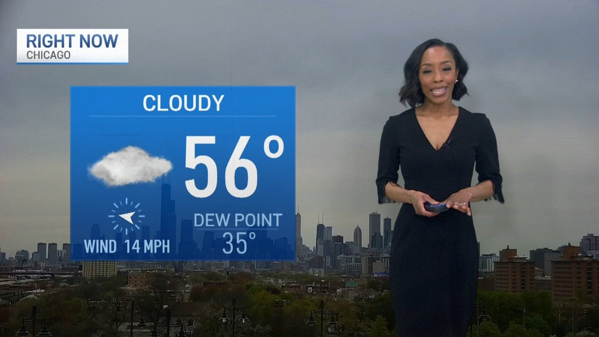
Warmer temperatures and the chance for showers and storms were headed to the Chicago area for the weekend, the NBC 5 Storm Team reported.
According to NBC 5 Meteorologist Alicia Roman, Friday morning started out dry, with temperatures significantly warmer than Thursday, when parts of the area saw freeze warnings and frost advisories.
Temperatures Friday afternoon will peak in the 50s and 60s, Roman said. Even warmer temperatures expected for the weekend.
However, those temperatures however come with an active weather pattern, forecast models showed.
"Summer warmth," Roman said, of the warm weekend weather ahead. "But the downside is we have some showers and storms."
Around 11 a.m., showers were expected to move into the western counties. By 2 p.m., those storms were expected to fill Chicago, Roman said.
Storms were expected to continue through 4 p.m. or 5 p.m., Roman said, potentially creating travel issues for the afternoon commute.
Local


A second wave of showers and storms was expected to come around 9 p.m. and continue overnight, Roman said.
According to the National Weather Service, Friday afternoon and evening, parts to the west, including DeKalb, Kane, Grundy and LaSalle Counties will be under a "marginal" risk of severe weather, which ranks as level one of five on the Storm Prediction Center's severe weather scale.
Feeling out of the loop? We'll catch you up on the Chicago news you need to know. Sign up for the weekly Chicago Catch-Up newsletter here.
Gusty, damaging winds and the chance for small hail were the main threats associated with Friday's system, Roman said.
Over the weekend, the chances for strong to severe storms continues.
Saturday was expected to see some dry time. However, an isolated shower or storm could form Saturday afternoon or evening, Roman added.
Saturday will also see "summer-like temperatures" the NWS said, with highs in the upper 70s to low 80s. Areas near the lake were expected to remain cooler.
Saturday was also expected to be windy, the NWS said, with wind gusts up to 40 miles per hour at times.
Sunday, temperatures remain in the 70s and 80s, Roman said. Higher rain and storm chances return Sunday afternoon, Roman said, some of which could be on the stronger side.
While the active weather pattern was expected to continue into Monday, temperatures were expected to remain warm, with highs in the 70s.

