


If you've enjoyed the Chicago area's recent spring-like weather, brace yourself: we're about to swing back into winter, as temperatures will go from 50 degrees to blustery winds, sleet and accumulating snow over the next few days, the NBC 5 Storm Team says.
While you get your snow boots and winter coats out of storage, here's a breakdown of what the Chicago area forecast looks like, beginning with Wednesday.
Wednesday
According to the NBC 5 Storm Team, a wind advisory bringing strong, sustained winds of 20-to-25 miles per hour and gusts as high as 50 mph is in effect for the entire Chicago area through noon. Forecast models show the strongest gusts can be expected throughout the morning commute, between the hours of 6 a.m. and 10 a.m.
Feeling out of the loop? We'll catch you up on the Chicago news you need to know. Sign up for the weekly Chicago Catch-Up newsletter here.

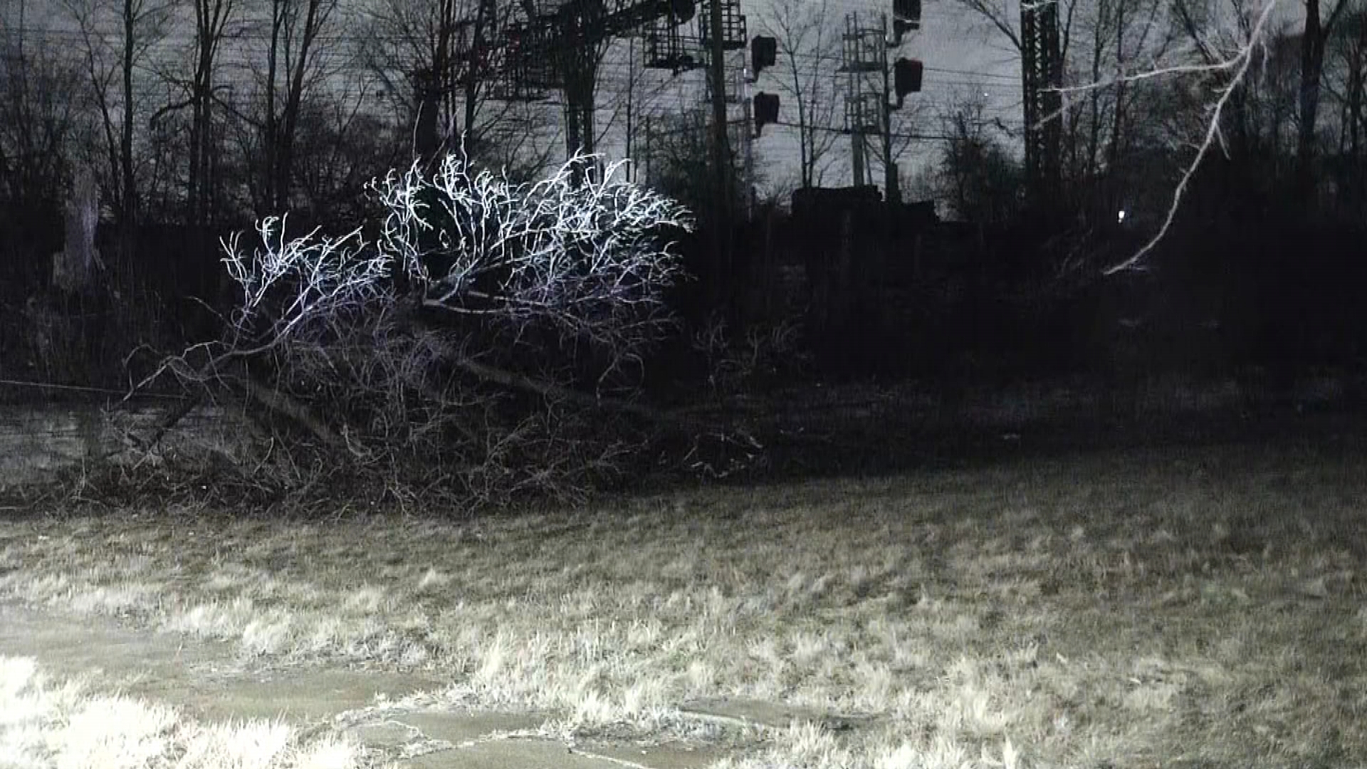
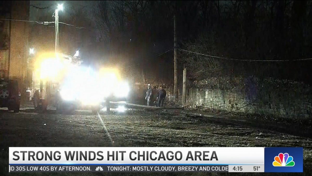
At Mount Carmel High School in Chicago's Woodlawn neighborhood, classes were canceled due to a downed tree that caused a power outage "throughout parts of its campus", administrators said in a Facebook post.
Early Wednesday, winds at O'Hare airport clocked in at around 36 mph. By 9 a.m., winds in McHenry and Lake counties had clocked in at 60 mph, with 65 mph winds recorded at Midway International Airport.
Local


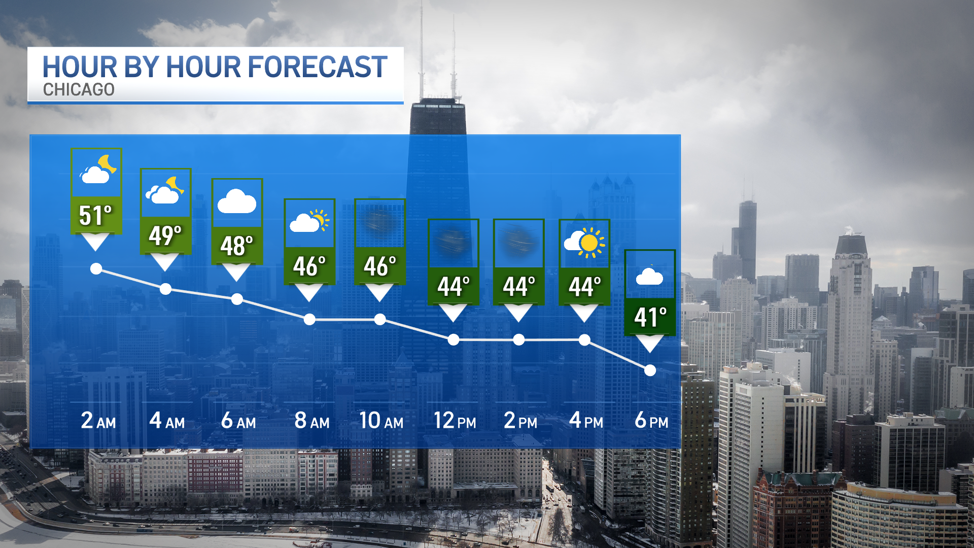
Overnight rain showers are expected to come to an end Wednesday morning, the NBC 5 Storm Team says, as much of the day is predicted to be cloudy, windy and dry.
Additionally, Wednesday's warm high of around 50 degrees was hit in the wee morning hours, and temperatures are expected fall to the mid 30s to low 40s by 4 p.m., forecast models show.
Thursday
Winter will make a rather abrupt return to Chicago late Wednesday night into Thursday, the NBC 5 Storm Team says, as a winter weather watch for north central and northeast Illinois will go into effect at 3 a.m. and continue through 9 p.m. Thursday.
According to the National Weather Service, a wintery mix of freezing rain, sleet and winds gusting as high as 40 mph are likely to create slippery, potentially hazardous travel conditions for much of the Chicago area, during both the Thursday morning and evening commutes.
In Lake and McHenry counties, a winter storm watch will go into effect at 3 a.m., with winds of up to 40 mph and the potential for heavy snow accumulations between three and six inches. Total accumulations could exceed six inches in some places, along with minor ice accumulations.
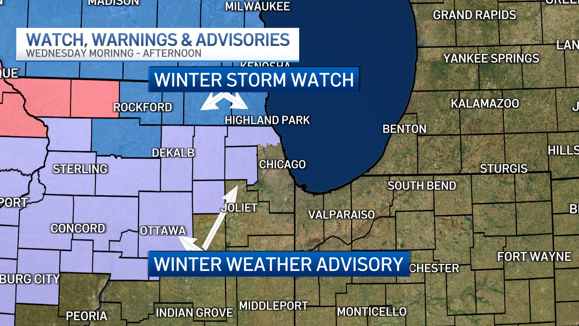
DeKalb, DuPage, Kane, Kendall and Lasalle counties could see between two and four inches of accumulation.
According to the NBC 5 Storm team, the snow is expected to begin after the morning commute, potentially snarling roads as drivers hit the roads in the afternoon.
Additionally, temperatures are expected to fall below freezing by Thursday night, with highs in the low-to-mid 30s.
Friday Through the Weekend
As that system moves out, even colder temperatures expected Friday, with below-average highs in the upper-20s throughout the Chicago area.
But there's some good news, too: High temperatures will rebound quickly over President's Day weekend, with sun and highs rising back into the 40s by Saturday. According to the NBC 5 Storm Team, temperatures are expected to remain in the 40s through Sunday.

