


Brant Miller
After several days of above-average temperatures, a cooldown could cause hazardous travel conditions overnight, with the formation of black ice possible across the Chicago area.
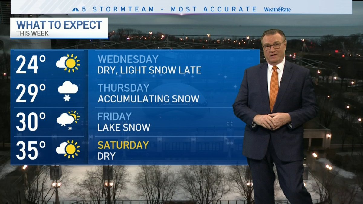
The cold temperatures just the beginning of another stretch of unsettled and chilly weather, with several chances for snow coming to the area to wrap up the work week.
According to a special weather statement from the National Weather Service, black ice and slick spots on roadways could occur all across the NBC 5 viewing area, which includes McHenry, Lake, DeKalb, Kane, DuPage, LaSalle, Kendall, Grundy, Kankakee, Cook and Will counties in Illinois, as well as Lake, Porter, LaPorte, Newton and Jasper counties in Indiana.
Forecasters say that untreated and less-traveled roads will see the brunt of the impact, but sidewalks could also freeze over in many locations as temperatures continue to nose-dive after hitting the 50s in some locations in recent days.
While Wednesday will remain mostly dry, a cold front could move in from Lake Michigan late in the day and into Thursday, bringing with it a light dusting of snow for some communities.
Thursday will see another, larger weather system moving in from the southwest, and this one could bring accumulating snow with it, with 3-to-4 inches of snow possible in some locations.
Friday could see even more snow, with lake-effect snow carrying down from the north and potentially adding in a bit more accumulation in some spots near the shoreline.
Local


By Saturday things will dry out and begin to warm up, with high temperatures in the mid-to-upper 30s possible to start out the weekend.
Feeling out of the loop? We'll catch you up on the Chicago news you need to know. Sign up for the weekly Chicago Catch-Up newsletter here.

