


Steady Snow Is On The Way
Portions of the Chicago area could see several inches of snowfall this week, as a winter storm moves into the area beginning Tuesday.
A winter storm watch was initially issued for nearly all of northern Illinois and northwest Indiana, though the counties impacted in Illinois were downgraded to a winter weather advisory late Monday and early Tuesday.
At least three Indiana counties have also been downgraded to winter weather advisories, including Lake, Newton and Jasper counties.
A winter storm watch will go into effect for LaPorte County in northwest Indiana at 7 pm. Eastern Tuesday evening and will last through Wednesday night.
Total snow accumulations in excess of six inches are possible, and gusty winds in excess of 35 mph could cause blowing and drifting snow.
The winter weather advisory will take effect at 6 p.m. Tuesday, lasting until 6 p.m. Wednesday, in Will, Grundy, LaSalle, Kankakee, DuPage, Cook and Kendall counties in Illinois, according to the NWS. Forecasts predict snow accumulations between 1 to 3 inches in those areas, making for slippery road conditions that could impact the morning commute on Wednesday.

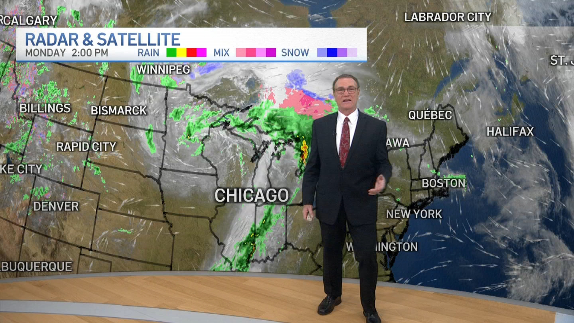
The storm continues to evolve, according to NBC Storm Team 5 meteorologist Andy Avalos, and it now appears it will not produce as much snow as it did just a day ago.
Tuesday will likely see a light mix of snow and rain transitioning to all snow by the evening. A few inches of accumulation is possible by Tuesday evening as steady, moderate snow continues overnight.
Wednesday will likely begin with light to moderate snow that will taper off through the afternoon before ending. Snow totals will range from an inch or less in far northwest counties, to between 1 and 3 inches in the city, as well as west and south. Northwest Indiana will likely see between 4 and 6 inches, though all totals may change as the storm develops.
Several factors are expected to come into play that will dictate just how much snow the area will see, and where the snow will fall. Beginning Tuesday night, forecast models show the potential for lake enhancement of the snow, meaning that winds off of Lake Michigan could help add moisture to the storm system, causing even more snow to fall.
A lakeshore flood warning was also issued, taking effect at 3 p.m. Wednesday for the shores of Illinois and Indiana. Large waves, flooding and beach erosion was expected in some locations.

