


NBC 5 Storm Team Meteorologist Iisha Scott has what you can expect to end the work week and details on a looming threat of potential severe weather.
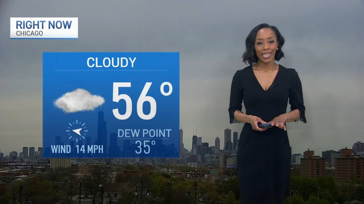
While Friday in the Chicago area started out clear and dry, an active weather pattern was set to move in by afternoon, with warmer temperatures, rain, storms and the chance for severe weather.
"Periods of rain over the next several days," NBC 5 Meteorologist Iisha Scott said. "But it doesn't look to be a washout."
According to Scott, there will be dry time Friday, Saturday and Sunday, and temperatures will be significantly warmer. However, storms bringing the threat of hail, gusty winds and even the potential for a tornado loom over the weekend forecast.
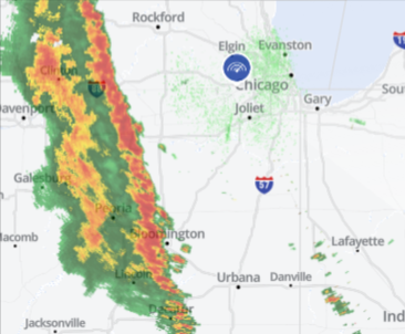
Late Friday morning, rain and rumbles of thunder had started to spread across Illinois' far southwestern counties, Scott said. In the early afternoon, those showers and storms will rotate up and into Chicago, with waves of rain chances continuing through the afternoon and into the early evening.
A second wave of showers and storms was expected to come later tonight and continue overnight, the NBC 5 Storm Team said.
According to the National Weather Service, Friday afternoon, parts to the west, including DeKalb, Kane, Grundy and LaSalle counties will be under a "marginal" risk of severe weather, which ranks as level one of five on the Storm Prediction Center's severe weather scale.
Gusty, damaging winds and the chance for small hail were the main threats associated with Friday's system, the NBC 5 Storm Team said.
Local


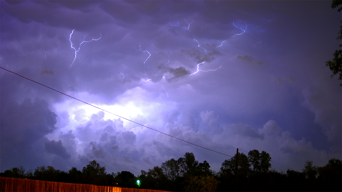
Over the weekend, the chances for strong to severe storms increase.
Saturday will see some dry time, Scott said. However, an isolated shower or storm could form Saturday afternoon or evening, Scott said.
Feeling out of the loop? We'll catch you up on the Chicago news you need to know. Sign up for the weekly Chicago Catch-Up newsletter here.
According to the NWS, any storms that do form Saturday could turn strong or severe.
Saturday evening, parts to the north and west will be under a "slight" risk of severe weather, which ranks as level two of five. Parts to the east and south will be under a "marginal" risk, the Storm Prediction Center showed.
"Hail, gusty winds and a brief tornado possible are Saturday night," Scott said.
Saturday will also see "summer-like temperatures" the NWS said, with highs in the upper 70s to low 80s. Areas near the lake were expected to remain cooler.
Sunday, temperatures remain in the 70s and 80s, the NBC 5 Storm Team said. Higher rain and storm chances return Sunday afternoon, some of which could be on the stronger side.
While the active weather pattern was expected to continue into Monday, temperatures were expected to remain warm, with highs in the 70s.

