
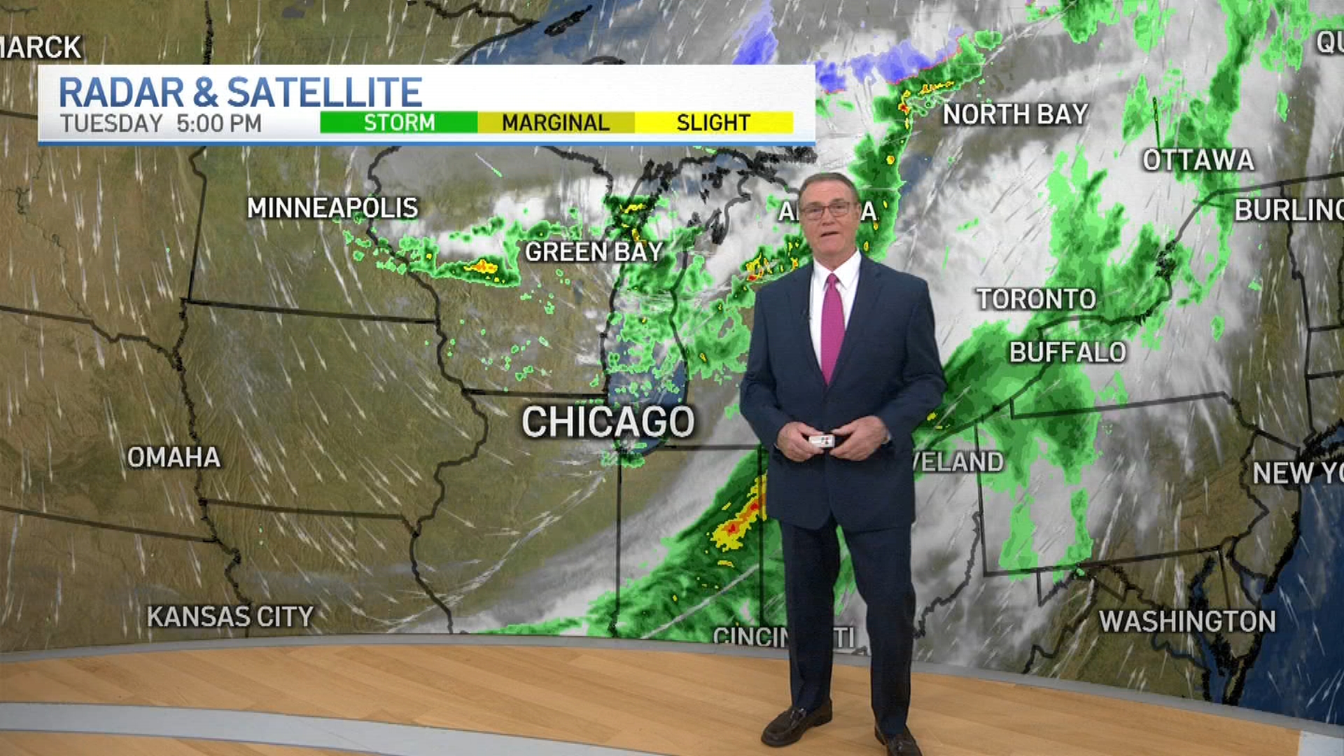
NOTE: Track live radar of the storm as it nears landfall in the feed above and below.
Hurricane Ian's most damaging winds began hitting Florida's southwest coast Wednesday, lashing the state with heavy rain and pushing a devastating storm surge, but by 1 p.m. CT the storm had still not officially made landfall.
According to NBC 5 Storm Team Meteorologist Paul Deanno, the hurricane was expected to make landfall Wednesday afternoon in Florida, though the storm is slowly moving across the Golf Coast.
As of 1 p.m. CT, the National Hurricane Center said Ian was "very near the coast of southwestern Florida Peninsula."
Feeling out of the loop? We'll catch you up on the Chicago news you need to know. Sign up for the weekly Chicago Catch-Up newsletter here.
Ian’s center was about 50 miles (80 kilometers) west of Naples at 11 a.m. CT Wednesday, as it churned toward toward the coast at 9 mph (15 kph). Ian’s plodding pace meant the storm was expected to spend a day or more crawling across the Florida peninsula, dumping flooding rains of 12 to 18 inches (30 to 45 centimeters) across a broad area including Tampa, Orlando and Jacksonville in the state’s northeast corner.
Weather
Fueled by warm waters in the Gulf of Mexico, Ian grew to a catastrophic Category 4 hurricane overnight with top winds of 155 mph (250 kph), according to the National Hurricane Center. The storm trudged on a track to make landfall north of the heavily populated Fort Myers area, which forecasters said could be inundated by a storm surge of up to 18 feet (5.5 meters).
“This is going to be a nasty nasty day, two days,” Florida Gov. Ron DeSantis said early Wednesday, stressing that people in Ian’s path along the coast should rush to the safest possible shelter and stay there.
Track live radar of the storm as it nears landfall in the feed above and special coverage will appear below as it is available.
