
Editor's Note: As of Thursday morning, an updated timeline can be found here. Our original story continues below.
Dangerous winter conditions are expected in the Chicago area this week, but the timing for when they could start has already shifted.
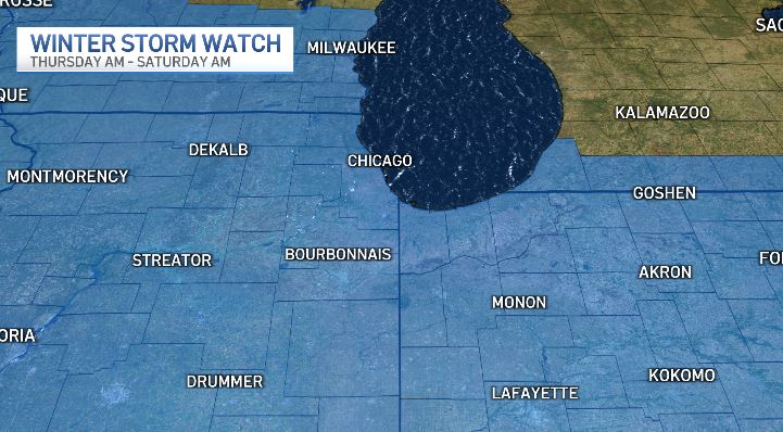
According to recent forecasts, it appears the timing of the storm has shifted earlier, with a winter storm watch now taking effect in some counties Thursday morning.
The watch was originally not expected to begin until Thursday evening, but the National Weather Service changed that designation Tuesday morning.
Feeling out of the loop? We'll catch you up on the Chicago news you need to know. Sign up for the weekly Chicago Catch-Up newsletter here.
The winter storm watch was moved up for some counties to as early as Thursday morning, including in McHenry, DeKalb, Kane, LaSalle, Kendall and Grundy.
Things will "rapidly" worsen heading into Thursday afternoon, with snow growing more widespread and becoming stronger.
A winter storm watch for Lake, DuPage, Kankakee, Cook and Will counties in Illinois, and Lake, Porter, Newton and Jasper counties in northwest Indiana, was also moved up, now beginning Thursday afternoon, according to the National Weather Service.
According to forecasters, the timing of the intensity was originally later, but new models show "slightly faster arrival of deteriorating conditions Thursday afternoon."
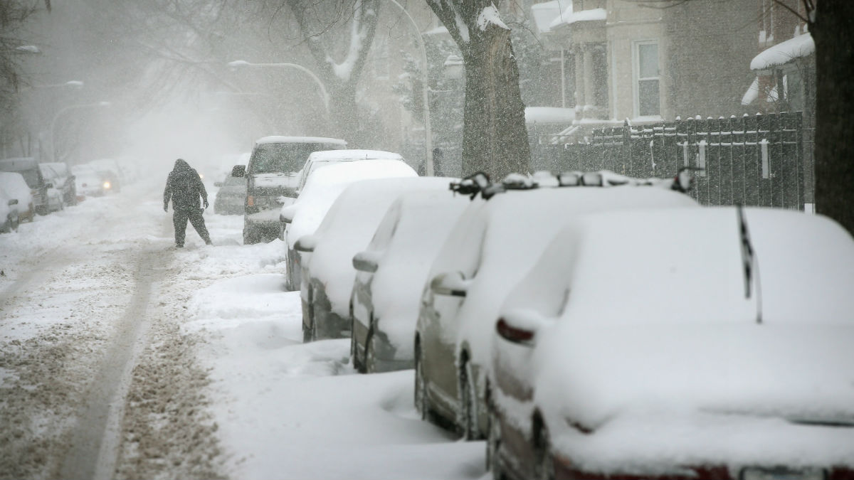
The alert warns that "falling and blowing snow may result in white out conditions with zero visibility at times, making travel extremely difficult, if not impossible."
"Power outages will also be possible as a result of strong damaging wind gusts to 55 mph," it states.
Icy roads could add to the hazardous conditions as temperatures rapidly fall.
The intense winter storm is expected to be widespread by the evening hours. This marks the time when it could could generate blizzard conditions and is expected to "severely" impact travel.
Major impacts are expected from the snowstorm throughout the day Friday.
Expect heavy snow, strong and damaging winds, difficult or near-impossible travel conditions and dangerously cold temperatures and wind chills.
Wind chill readings are expected to drop near -30 as early as Friday morning.
The winter storm watch is slated to continue through late Friday evening as the storm and potentially "blizzard-like" conditions hold strong.
Forecasts are unclear as to how much snow may actually fall as snow but the snow is expected to begin subsiding overnight.
Early predictions so far indicate the Chicago area could see between 5 and 9 inches of snow, with higher totals possible, especially in northwest Indiana. Some locations could also see lower totals.
Snow begins to lighten early Saturday morning, but hazardous travel conditions are slated to continue through the weekend as dangerous cold continues.
Minimum wind chills of -20 to -30 degrees are expected with highs in the single digits and low teens. Lake effect snow showers are also possible in parts of northwest Indiana, according to the NBC 5 Storm Team.
Difficult and impossible travel conditions could linger, particularly in the morning hours Saturday, as blowing and drifting snow remains a concern.
