
Multiple rounds of storms are set to make their way through the Chicago area Friday, some becoming strong to severe and bringing the threat of damaging winds, heavy rainfall, quarter-sized hail and isolated tornadoes.
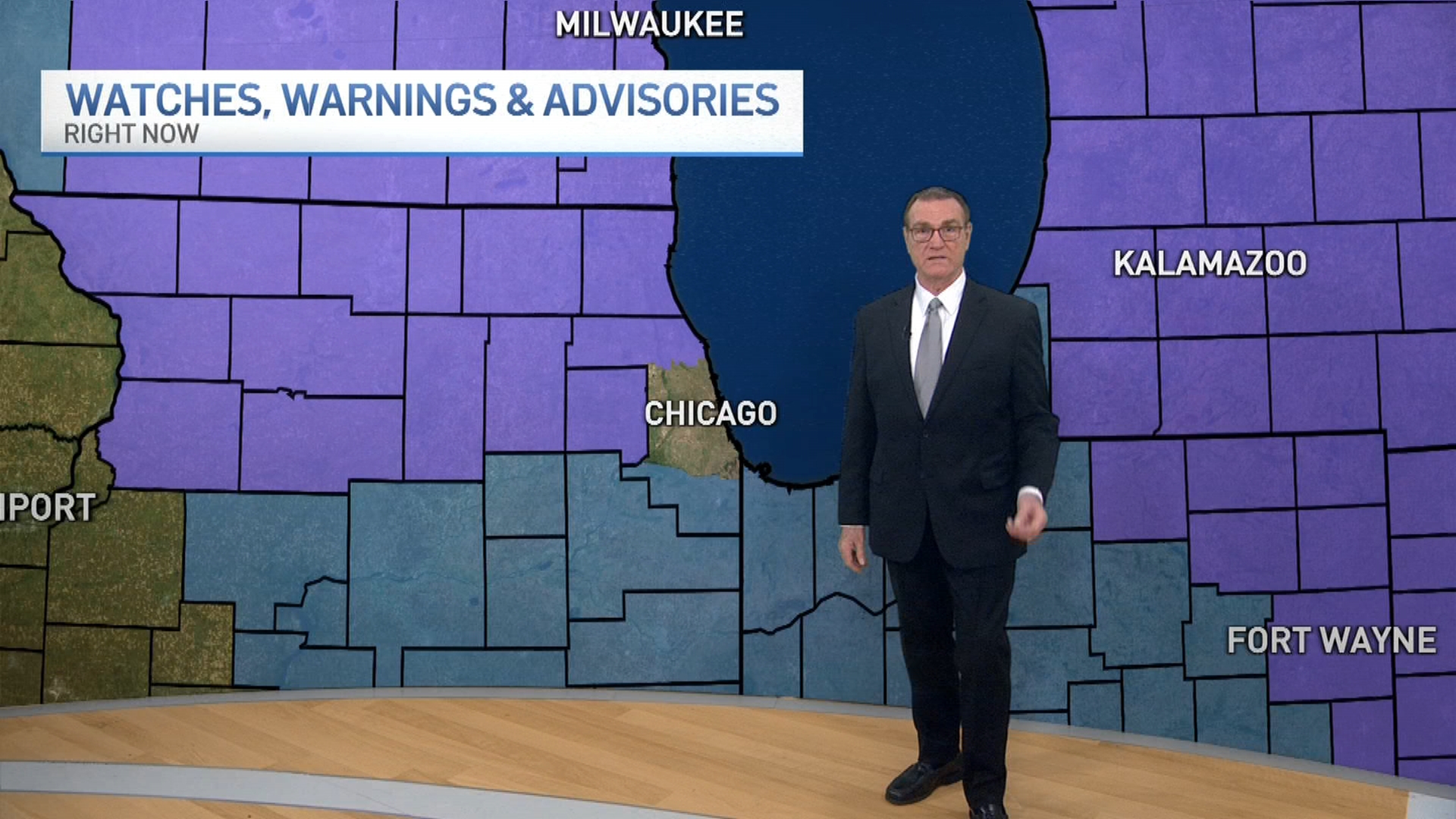
A severe thunderstorm watch was issued for nearly every county in the Chicago area, with the exception of Newton and Jasper counties in northwest Indiana, until 9 p.m. Friday.
After morning showers and storms, another round of stormy weather is set to move in later in the day.
A few storms are possible during the early afternoon hours, with strong to severe weather expected by the late afternoon and evening. The biggest threat comes with a line of storms that will travel through the area sometime between 5 and 11 p.m.
The largest risk with these storms will be the threat for wind gusts of up to 70 mph, though there is a chance an isolated tornado could develop.
The storms look to continue through the evening, gradually moving south and diminishing in intensity by Saturday morning.
Friday will be hot and humid with highs ranging from the mid-80s to low-90s - where they will stay through the weekend.
Weather
Saturday and Sunday will likely see several hours of dry conditions though a few storms will still be possible both days.
