
Spring is a time of renewal, but is also a time of chaotic weather, and Chicago is going to see plenty of that in the coming days, with a chance of severe weather kicking off the festivities.
That chance looms late Wednesday and into Thursday morning, with a chance of hail and heavy downpours existing for the area, especially south of Interstate 80.
After that system moves out, temperatures will cool a bit, and while highs will stick around their seasonal averages this weekend, several chances of rain and even some snow will exist, especially during the overnight hours.
Here is what we know about the coming weather.
Feeling out of the loop? We'll catch you up on the Chicago news you need to know. Sign up for the weekly Chicago Catch-Up newsletter here.
Late Afternoon/Early Evening Wednesday
Showers are expected to develop across the area throughout the afternoon, and will persist through the early evening, according to forecast models.
The chance exists for a bit of clearing at points, but most parts of the area will be impacted by the rain as the system starts to impart its influence on the region.
Weather
Late Evening Wednesday
While an isolated thunderstorm can’t be ruled out during the evening commute, that chance will slowly start to go up as the night moves along, especially after the sun goes down, according to forecast models.
While most thunderstorms won’t be overly-strong at this point in the system, some heavy downpours and gusty winds are possible, with temperatures remaining in the low-50s.
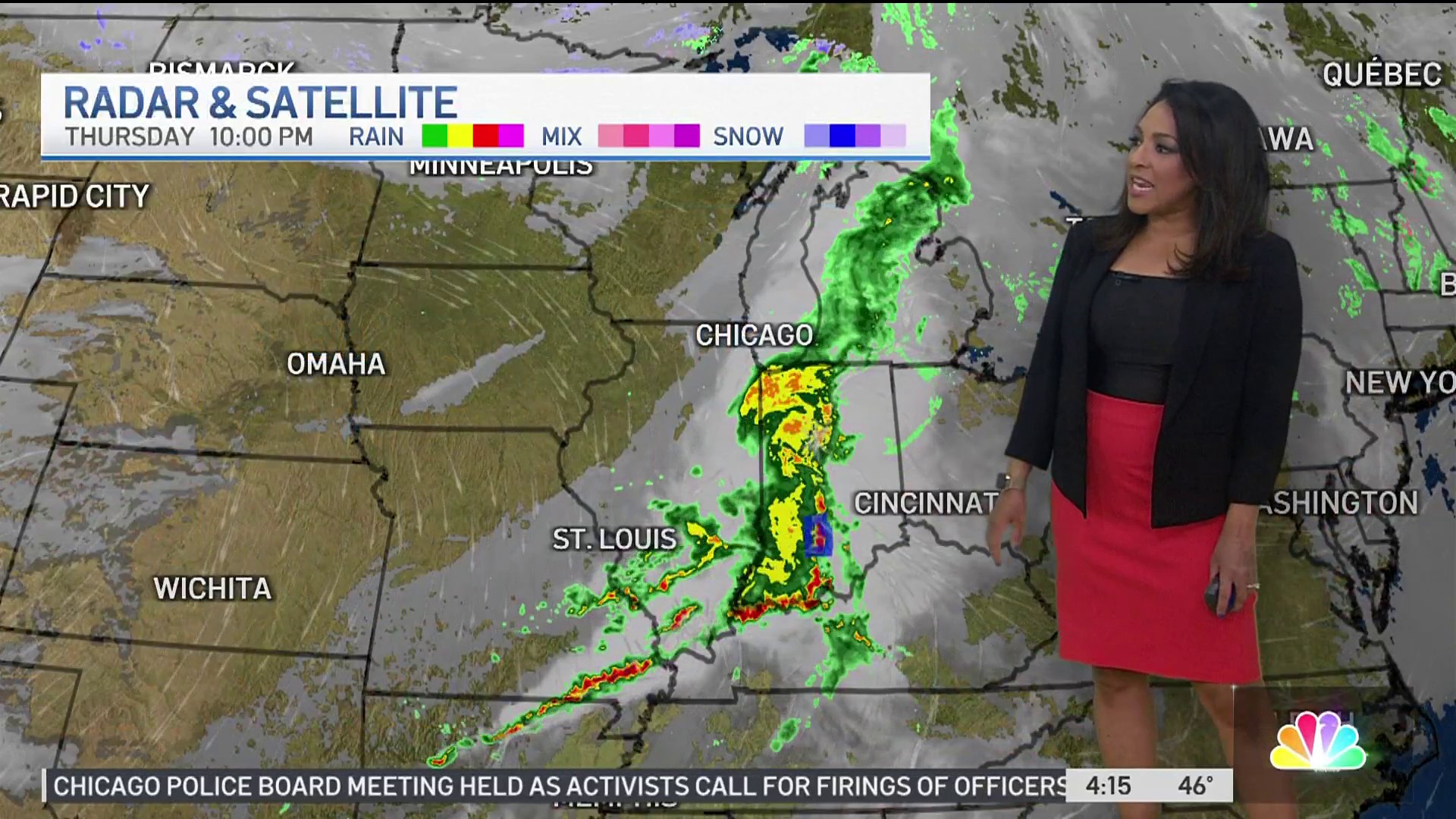
Overnight Thursday
The main event for the storm system should take place after midnight Thursday, with areas south of Interstate 80 and in northwest Indiana at a “marginal” risk of severe weather, according to the Storm Prediction Center.
The main threats with the storms will be hail, some of which could be the size of a quarter in diameter. Some gusty winds could also occur, along with heavy downpours, with some low-lying areas potentially seeing some pooling of water during the storms.
Outside of that area, thunderstorms could still impact the rest of the Chicago area, with gusty winds and locally-heavy rain possible at times.
The worst of the storms should be over by the time the morning commute rolls around, but rain could persist well into the morning.
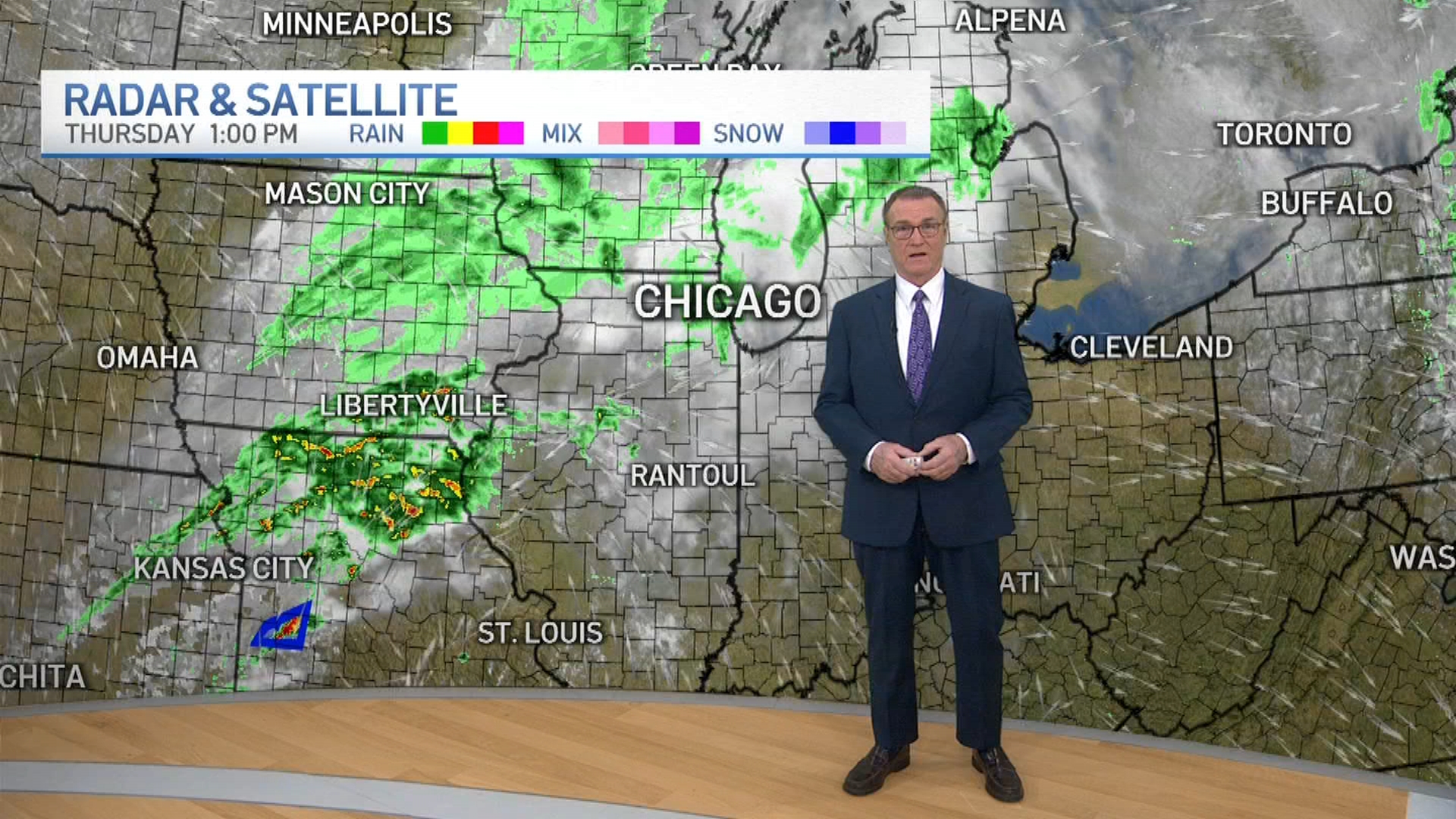
Thursday Morning
Rain will likely stick around past daybreak, with some thunderstorms still possible as motorists head to work in the morning.
That rain will slowly start to clear out as noon approaches, but colder temperatures will also take hold as a cold front finishes making its way through the area.
Friday
After a dry remainder of the day Thursday, Friday will likely just see some clouds during the daylight hours, but another system will slowly start to approach the area for a second round of precipitation, and this one could be different in nature.
Friday Night/Saturday
This system will mostly bring rain to the area on Friday night and into Saturday, but some locations could see some mixed precipitation, or even slushy snow, in the overnight hours as temperatures drop to around the freezing mark.
Significant accumulations are not expected, but the precipitation could cause some travel headaches early Saturday before the system clears out of the area.
Sunday/Monday
Another storm system is expected to arrive late Sunday and build in intensity on Monday, with more rain expected south of Interstate 80.
Snow and mixed precipitation could occur in the northern suburbs and near the city of Chicago itself, but at this time it is unclear whether air temperatures will be cool enough to allow for that to happen.
Stay tuned to the NBC 5 Storm Team’s forecasts on our newscasts, which can be seen on our 24/7 Streaming News Channel, and can be found on the NBC 5 app on Google Play and the Apple App Store.
You can also sign up for mobile news and weather alerts via our mobile app to keep you safe during severe weather.
