
When it comes to Springtime in Chicago, there's often good news and bad news.
The good news? Wednesday will see above average temperatures near 70 degrees.
The bad news? Parts of the Chicago area could potentially get slammed with multiple rounds of showers and thunderstorms, with the possibility of hail, localized flooding, and even a brief tornado.
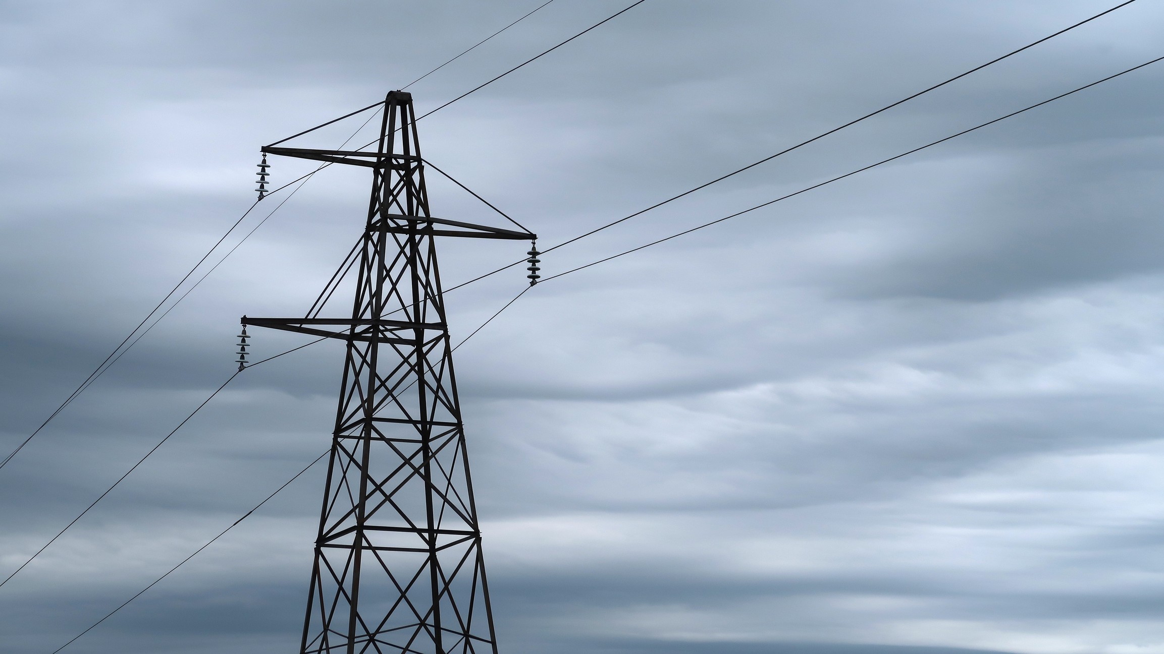
But the greatest risk the storms will bring will be gusty, damaging winds.
Feeling out of the loop? We'll catch you up on the Chicago news you need to know. Sign up for the weekly Chicago Catch-Up newsletter here.
According to NBC Chicago Meteorologist Alicia Roman, some areas may see winds with gusts up to 65 miles-per-hour, capable of downing trees and powerlines.
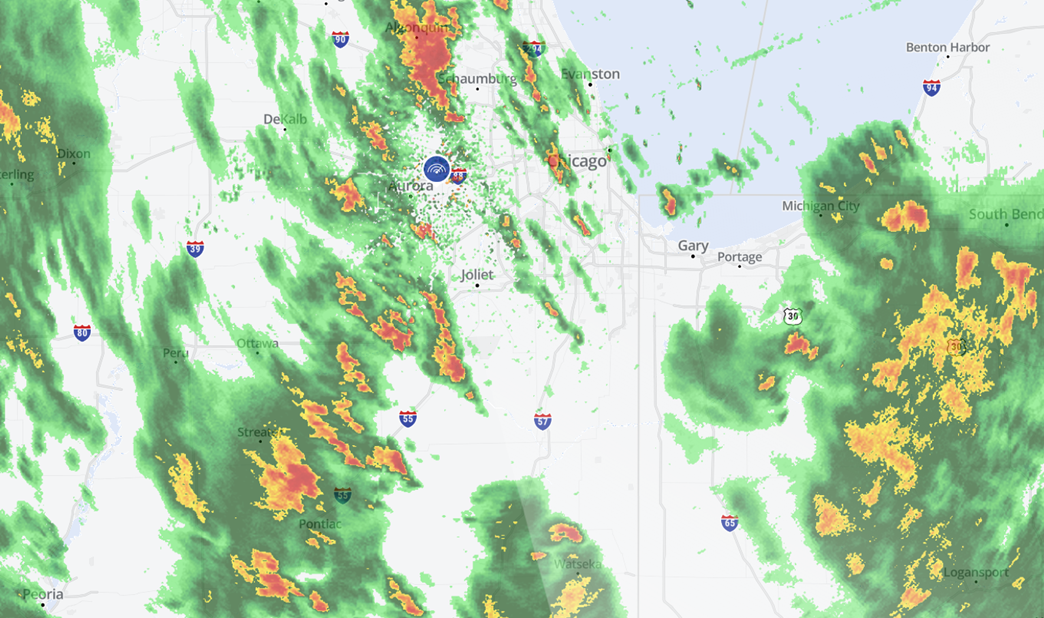
According to the NOAA’s Storm Prediction Center, the greatest risk for severe weather remains in counties south of the city, including Will, Kankakee, Newton and Jasper. In those areas, there's an "enhanced" risk for severe weather, meaning the numerous, highly concentrated thunderstorms are possible.
The rest of the Chicago area, including the city itself, is under a “slight” risk of severe weather — meaning there's potential for a few strong storms.
While early rounds of weather is expected to produce scattered showers, the main threat of storms and severe weather won’t arrive until the afternoon and evening hours.
The worst of the weather expected to hit south of Interstate 80.
Even after the storms make their way through the area, gusty winds are expected to persist through at least Thursday, along with cooler temperatures and drier conditions.
Highs will drop below their seasonal averages for a period of several days, with highs in the upper-40s and low-50s through at least the start of the new work week.
