
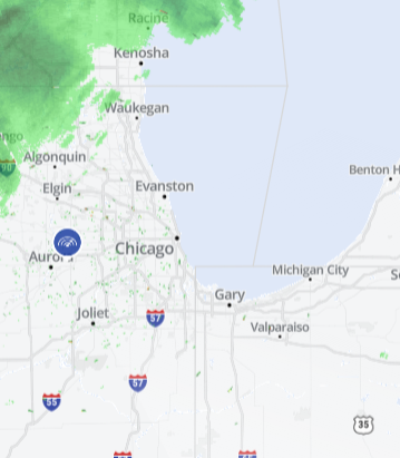
Rain and storms expected to hit the Chicago area over the next few days could bring with them record-breaking heat for the weekend.
The first chance for showers and thunderstorms moves in early Thursday morning, though there is a limited risk for severe weather.
Temperatures will stay cooler Thursday, ranging from the upper-60s along the lakefront to the mid- to upper-70s inlnd.
The chance for showers and storms lingers into the overnight hours, when heavy rain is possible.
Friday will see another chance for scattered storms in the morning as warmer conditions move in, bringing temperatures in the mid- to uper-80s.
Saturday looks to be the warmest day of the week as temperatures reach into the low- to mid-90s. The hot and humid conditions mean showers and thunderstorms are likely, but not until late in the day or evening.
But things change dramatically heading into Sunday as temperatures dip nearly 30 degrees with drier conditions.
Local
Sunday highs will likely range from the low-to mid-60s along the lakefront to the the 70s inland.
