
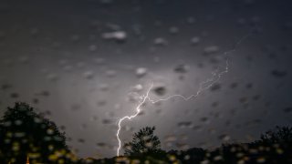
Several counties in Illinois and Indiana could see strong, scattered thunderstorms Monday, potentially accompanied by small hail and gusty winds.
According to the NBC 5 Storm Prediction Center, a storm cell moving towards the city may bring thunderstorms to the Chicago area in the late afternoon, around 5 p.m. and into the evening.
Storms will be largely along and east of Interstate 55, the National Weather Service says.
The risk for severe thunderstorms is "slight," with the biggest threats being powerful, damaging wind gusts up to 70 miles-per-hour, and the possibility of quarter-sized hail.
Feeling out of the loop? We'll catch you up on the Chicago news you need to know. Sign up for the weekly Chicago Catch-Up newsletter here.
Impacted counties in Illinois include much of the Chicago area, including Lake, DuPage, Cook and McHenry, and Lake, Porter, Newton, Jasper and Benton in Indiana.
According to Storm Team 5, temperatures highs Monday are expected to be in the mid-80s to low 90s. The rest of the week is expected to be drier, with temperature highs in the 80s but cooler along the lake.
