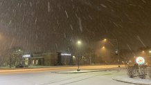
A winter weather advisory now in effect across the entire Chicago area has brought low visibility, slick, slippery roads, and widespread snow, with "peak snowfall rates" occurring during the Wednesday morning commute, the National Weather Service says.
Although the advisory will stretch until 6 p.m. Wednesday evening, the snow's strongest, steadiest impact is expected to occur through lunchtime, the NBC 5 Storm Team says.
But Wednesday isn't the only day expected to bring snow showers and accumulation to the area.
Feeling out of the loop? We'll catch you up on the Chicago news you need to know. Sign up for the weekly Chicago Catch-Up newsletter here.

According to the NBC 5 Storm Team, the flakes are expected to taper off by Wednesday afternoon, but some showers are predicted to linger through Thursday. And, two additional storm systems moving through the area Friday and Saturday could bring more accumulation.
Here's the latest weather timeline of snowfall in the Chicago area, and how much accumulation is expected.
Local
Wednesday and Thursday
"Peak snowfall rates" are expected through the Wednesday morning commute, with the heaviest accumulation predicted to last through 10 a.m., according to the National Weather Service.
While snow showers in Lake, DuPage and Cook counties are expected to taper by Wednesday between 12 p.m. and 1 p.m., light and scattered lake effect showers are expected to continue through the evening and into Thursday, particularly in Lake, Porter and LaPorte counties in Indiana.
According to forecast models, by Thursday evening, intermittent, additional snow showers could bump accumulation numbers.
Temperatures Wednesday and Thursday, the NBC 5 Storm Team says, are expected to hover in the low-to-mid 30s, but dropping as the week continues.
Friday, Saturday and Sunday
A quick, second system is expected to blow through Illinois and Indiana on Friday, with some mixed precipitation and additional snow possible, according to forecast models.
While accumulations likely won’t amount to much, more will be arriving behind it as the weekend continues.
Saturday, an afternoon system is predicted to push snow into northern Illinois, the NBC 5 Storm Team says, hitting areas to the west and north of Chicago harder than Wednesday’s system likely will.
That snow will likely stick around through the afternoon hours on Sunday, bringing additional accumulations and causing more travel concerns on area roadways.
Temperatures Friday are expected to be in the low to mid 30s, the NBC 5 Storm Team says. By Saturday however, temperatures will fall, with highs in the mid 20s to low 30s.
Sunday is expected to be cloudy and cold, with highs in the upper 20s.
Expected Snowfall Totals
According to the NBC 5 Storm Team, Wednesday into Thursday, the heaviest accumulations of snow will likely occur around Lake Michigan and in northern Indiana, with two to four inches of snow possible across Cook, DuPage, Kendall, Will, Kankakee and Grundy counties in Illinois.
In northern Lake county in Illinois, those totals may be a bit lower, with forecast models showing up to two inches.
In Lake, Porter, Newtown and Jasper counties in Indiana, however, those totals are likely to be higher, with four to five inches of accumulation possible.
Additionally, lingering showers, especially in Northwest Indiana, could bring accumulations higher.
Saturday and Sunday, snow is expected to bring a heavier impact on Chicago's northern and western suburbs, but the track of the storm could potentially change in coming days as more data comes into the NBC 5 Storm Team’s forecasts.
As things stand now, forecast models show an additional two to four inches of snow could be tacked on by Sunday evening, with the heaviest accumulations likely north of Interstate 80.


