
- Floods devastated portions of Yellowstone National Park and the surrounding area earlier this week. Satellite images taken before and after the floods give a sense of the scale.
- The flooding, caused by heavy rain and the rapid melting of snow, is "unprecedented," the National Park Service said.
- The northern portion of the park is "likely to remain closed for a substantial length of time," the park service said.
Floods decimated portions of Yellowstone National Park and the surrounding area earlier this week, and a series of satellite images from before and after the flooding show the extent of the damage.
The images show the tremendous power of what the National Park Service called "unprecedented flooding," caused by heavy rain and rapid snowmelt.
Feeling out of the loop? We'll catch you up on the Chicago news you need to know. Sign up for the weekly Chicago Catch-Up newsletter here.

While the flooding at Yellowstone may not be directly attributable to climate change, a 2018 study showed "climate change exposes the national park area more than the US as a whole" because the parks are generally located at especially high elevations or dry locations.
Yellowstone is massive, spreading across 3,472 square miles, primarily in Wyoming and edging into Montana and Idaho.
Money Report


The worst of the flooding happened in the park's northern portion, which is "likely to remain closed for a substantial length of time," the park service said in an update to its posted bulletin about the flooding.
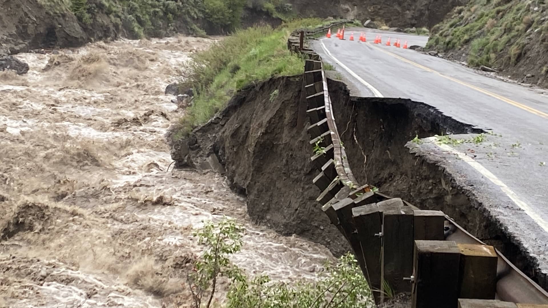
The three pairs of before-and-after satellite images, embedded below, give a sense of the scale of the water damage, which has caused buildings to wash into the Yellowstone River.
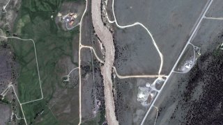
BEFORE: A road at the north entrance to Yellowstone National Park, seen here on March 30.
AFTER: This satellite image of the north entrance of Yellowstone was taken on June 15, after the flooding, and shows portions of the road washed out.
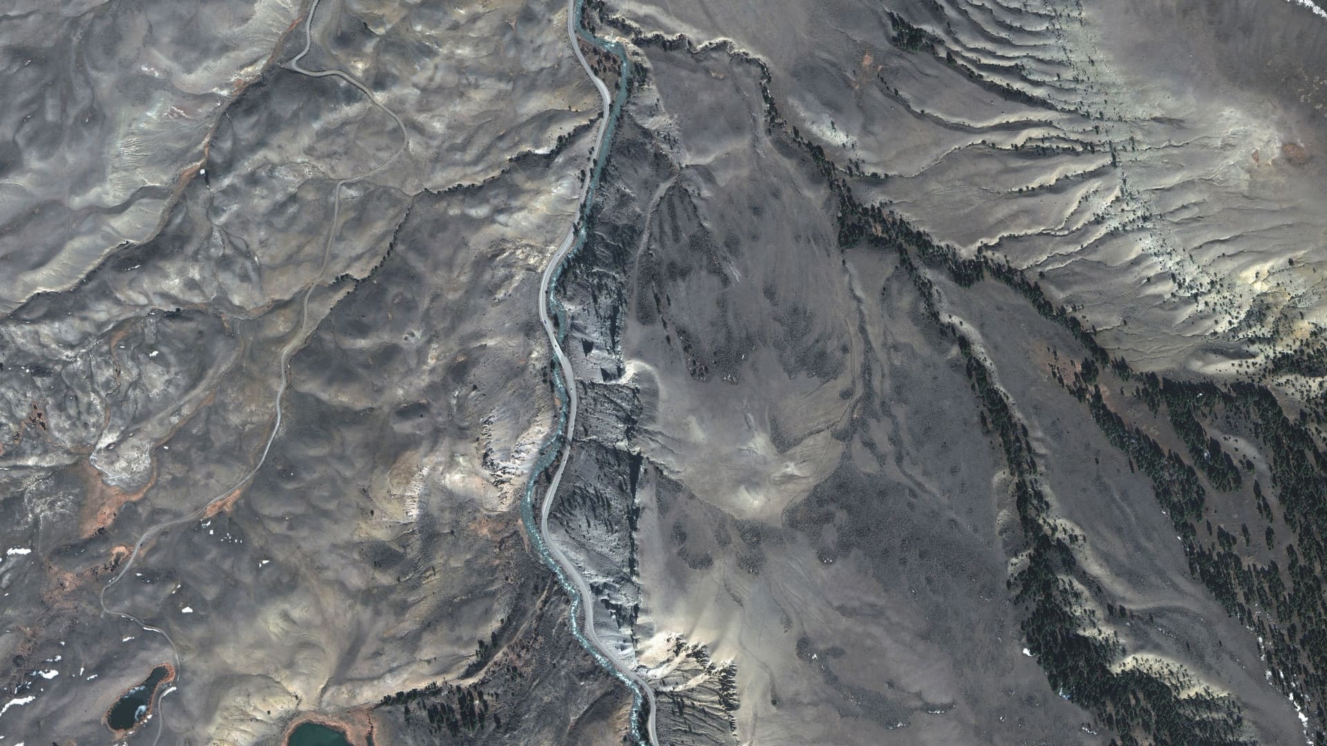
BEFORE: This is another view of a road on the north side of Yellowstone taken on March 30.
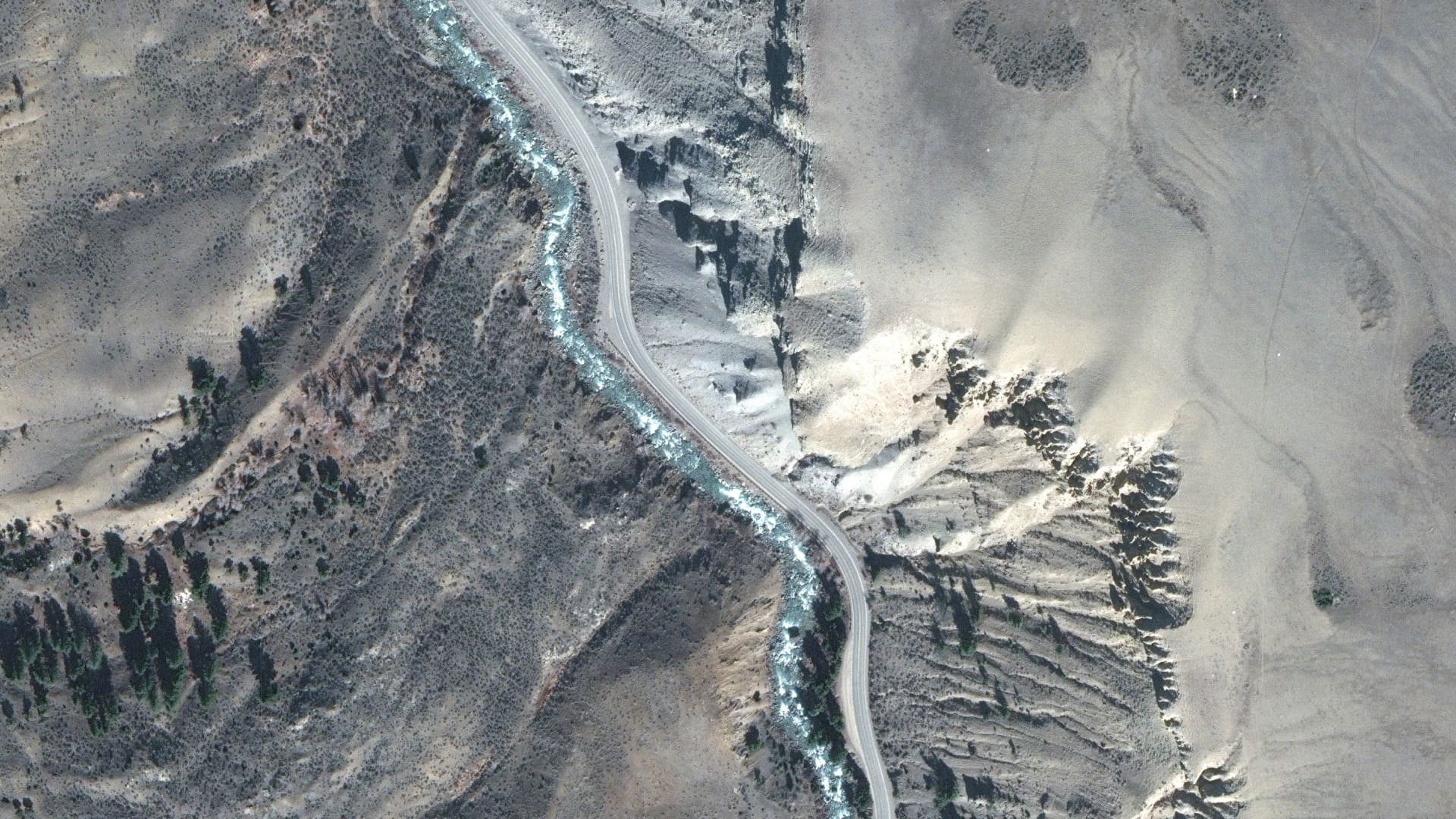
AFTER: This June 15 photo shows portions of the same road completely wiped out.

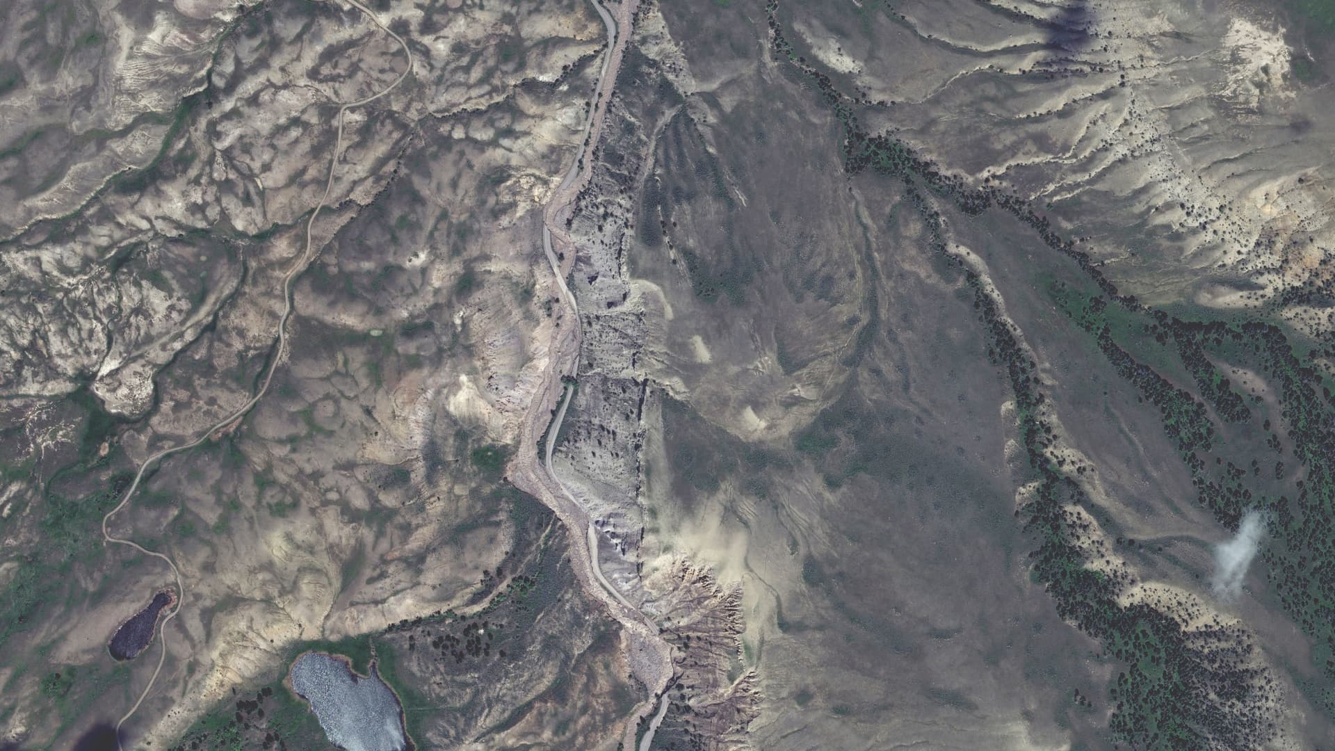
BEFORE: This photo was taken north of Yellowstone, near Carbella, Montana, on Sept. 6. The Yellowstone River runs through the center of the satellite image.
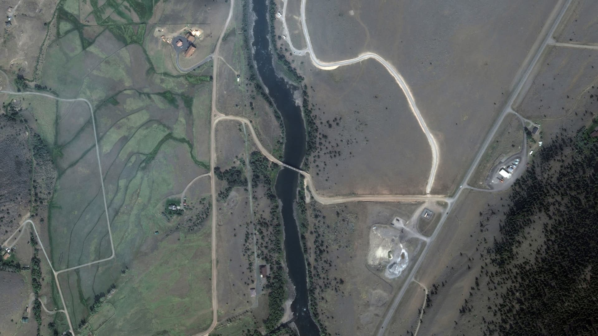
AFTER: This June 15 photo shows how the swollen river has overflowed its banks.
And this video shows a shed falling into the river:


